
Melbourne's first 30-degree days of spring
The temperature in Melbourne looks set to hit the 30-degee mark for the first time since March, with maximums of 30°C forecast for both this Thursday and Friday.
- Melbourne’s warmest spring day to date in 2026 was 28.5°C on September 20.
- So far this month, Melbourne's average maximum has been 20.9°C, which is 1.2°C above the long-term average of 19.7°C.
- While October has been warm overall, Melbourne has seen no significant heat spikes, especially compared to Sydney's 34.8°C day on October 12.
This week's pair of 30-degree Melbourne days won't be extreme in a month where the highest temperature in well over 100 years of records was 36.9°C, but it's a reminder that summer is on the way.
As is often the case with both cold and warm spells in Melbourne, Adelaide gets a taste first, and that will be the case this week with the SA capital expecting a top of 31°C on Thursday.
What is causing the warmth?
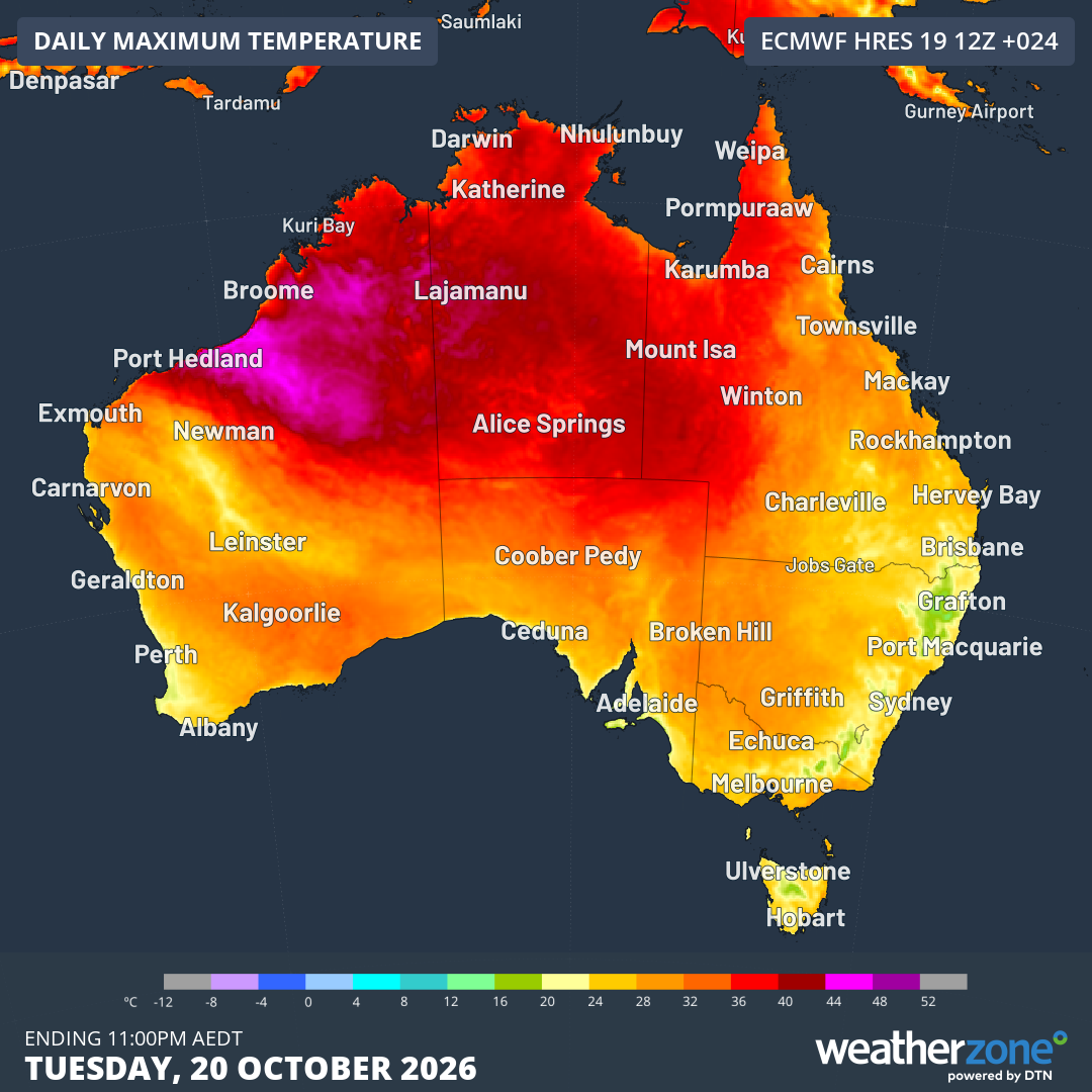
Image: Predicted maximum temperatures across Australia on Tuesday, October 20, 2026, according to the ECMWF model. Source: Weatherzone.
A very slow-moving high pressure system located over the Tasman Sea is causing northerly winds which are funnelling warm air from Australia's interior towards the country’s southern and southeastern states.
The image above shows areas of intense heat (the pink zones) in Western Australia's Pilbara and Kimberley regions, where the mercury reached 44.8°C on Monday at Mandora Station in the western Kimberley.
Some of that heat is tracking all the way southeast across the continent, including to Tasmania.
Meanwhile the east coast is under the influence of a moist, onshore flow which is moderating daytime temperatures. That's why Hobart is currently about halfway through a potential eight-day run where its maximum is exceeding Brisbane's.
Spring see-saw kicks in after warm spell
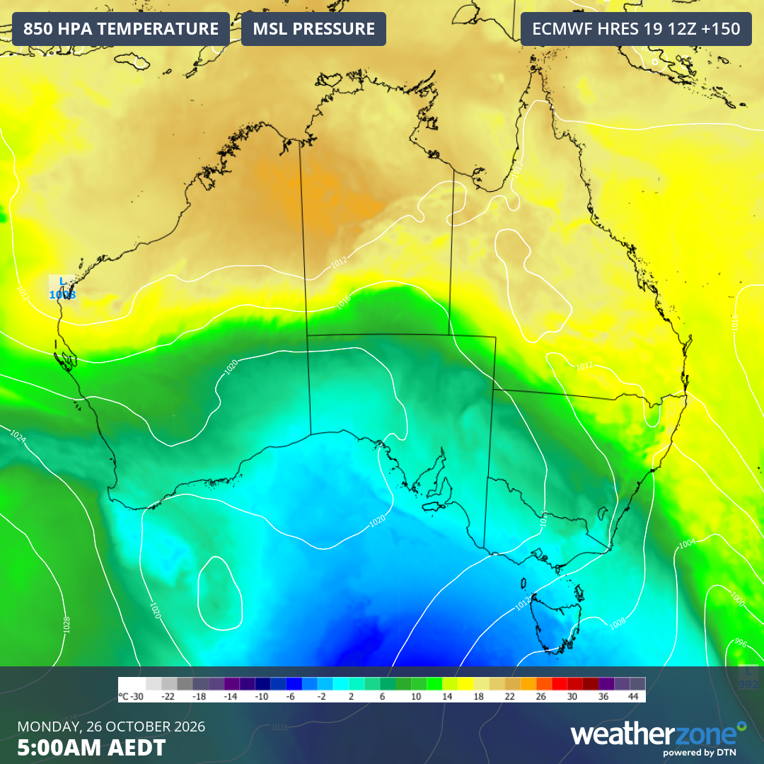
Image: Mean sea level pressure and 850 hPa temperatures showing much cooler air establishing over SE Australia early on Monday, October 26, 2026. Source: Weatherzone.
After Melbourne's warmth on Thursday and Friday, an in-between day is expected on Saturday with a maximum around 24°C as showers increase in a rain band ahead of an approaching cold front.
Melbourne's classic "spring temperature see-saw" will then reappear, with maximums of just 16°C and 15°C currently predicted for Sunday and Monday respectively.
At this stage, Monday looks like a chilly one right across southeastern Australia, with snow forecast for elevated parts of Tasmania and the mainland high country.