
Extreme fire danger as Sydney heads for 35°C
Sydney and much of New South Wales is in for a day of extremely hot weather for October, with maximums around 35°C expected in the city and some coastal suburbs, and even hotter temperatures likely in the city's west.
Extreme fire danger is part of the mix for the greater Sydney region, with the BoM issuing a fire weather warning at 4:20 am this Monday.
In western and northwestern New South Wales, the mercury could push up to around 40°C on Monday afternoon, before cooler conditions spread across the state from Tuesday for the rest of the working week.
Sydney's hottest day of spring to date
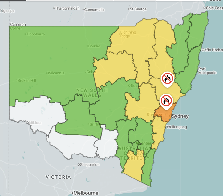
Image: NSW fire danger ratings for Monday, October 12, 2026. Source: NSW Rural Fire Service.
Sydney has already reached the 30-degree mark five times this spring, with a hottest day to date of 32.7°C on September 21.
The mercury had already climbed to 27.8°C by 11 am (AEDT) this Monday, indicating that today's city maximum will likely be at least 10 degrees above the average October maximum of 22.2. The mercury was already nudging 30°C in some western suburbs at 11 am.
Why it's so hot in New South Wales this Monday
As Weathezone meteorologist Joel Pippard explains, hot northwesterly winds ahead of a cold front and trough are pushing across NSW, drawing heat towards the coast.
"Those winds are helping to delay or prevent the sea breeze in Sydney, which is helping the city and some coastal suburbs get particularly hot."
The loop below shows the trajectory of the cloudband associated with the trough and cold front across southeastern Australia on Monday morning.
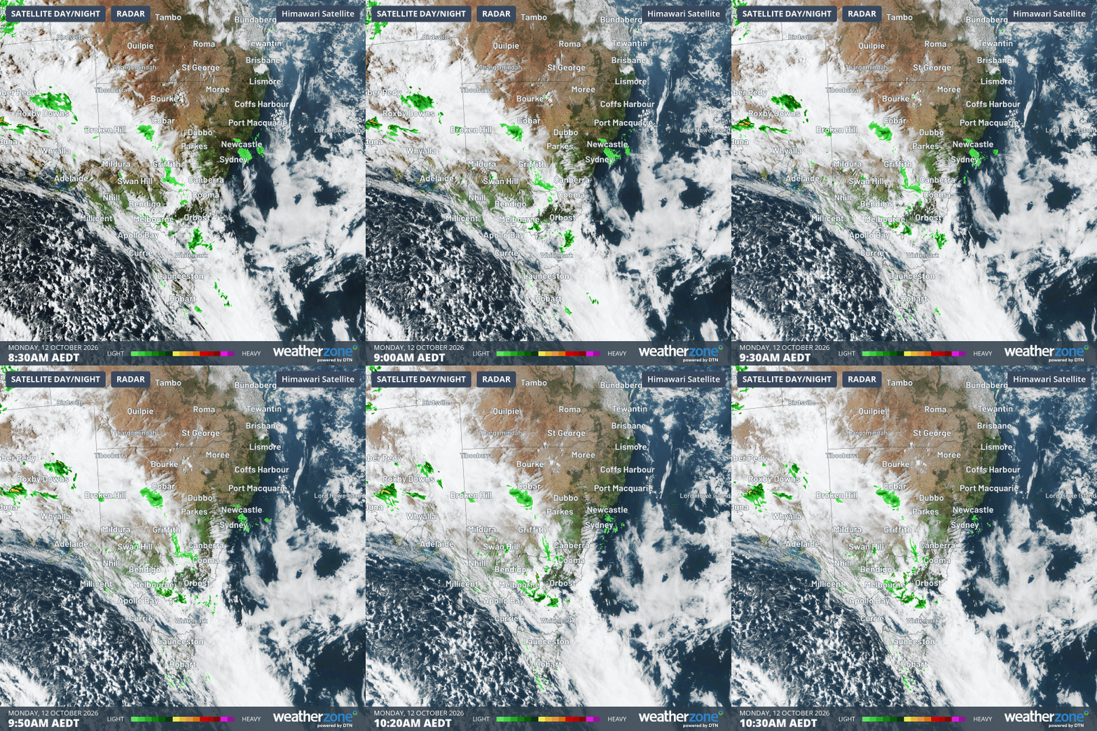
Image: Combined satellite and radar loop for SE Australia from 8: 30 am to 10:30 am (AEDT) on Monday, October 12, 2026. Source: Weatherzone.
Showers are impacting parts of Victoria and inland NSW, with an influx of air from the southwest beginning to cool things down in Victoria and parts of far southern NSW. But areas further north are under the influence of those warm northwesterlies.
Slight chance of storms later on Monday ahead of cool change
The cooler air won't reach most of NSW until Tuesday, with Sydney heading for highs around 20°C for the rest of the working week from Tuesday onwards, as showers spread across the city.
Thunderstorms could develop across large parts of the state on Monday afternoon, and even western Sydney could see a brief crackle of lightning. However any significant rainfall in the Sydney area is unlikely on Monday, which (in addition to the heat and gusty winds) is why the fire danger is rated as extreme.
Please check the latest warnings for your part of the country on the Weatherzone warnings page.
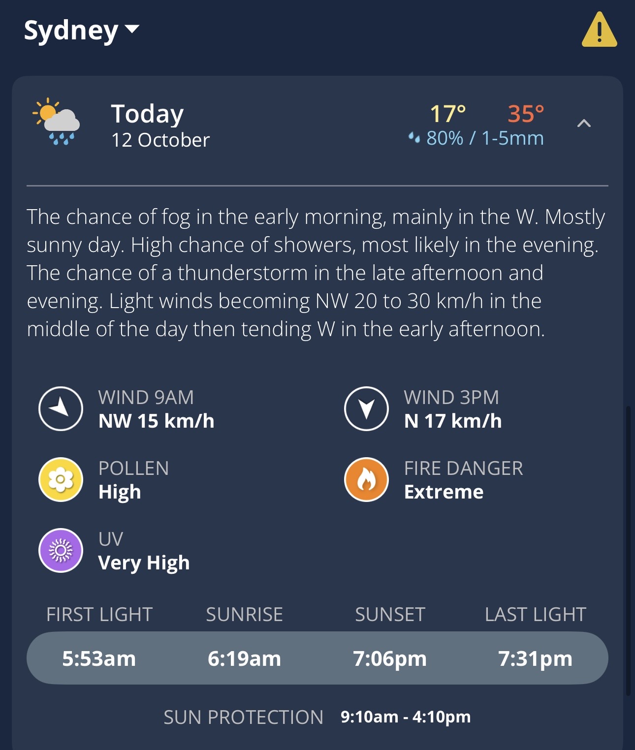
Image: Daily forecast for Sydney, NSW, on the Weatherzone app.