
Slow-moving Tasman Sea high to bring rain, storms and heat across Australia this week
An unusually slow-moving high pressure system centred over the Tasman Sea will cause a contrasting mix of weather across Australia this week, with heavy rain and thunderstorms in the country’s east and a spring heatwave in parts of the south.
Air flows in an anticlockwise direction around high pressure systems in the Southern Hemisphere. As high pressure systems are often large and slow moving, this anticlockwise flow can control weather conditions for several days, sometimes more than a week.
A large high pressure system will linger above the Tasman Sea this and remain near-stationary from now until the weekend. Computer models predict that the centre of this system will only move by about 500 km between Monday and Saturday. This is unusually slow of a large-scale weather system.
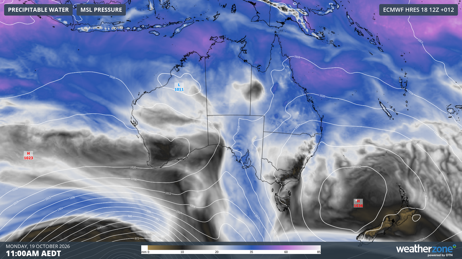
Image: Modelled mean sea level and precipitable water at 11 am AEDT on Monday, October 19, 2026, showing a high pressure system centred above the Tasman Sea.
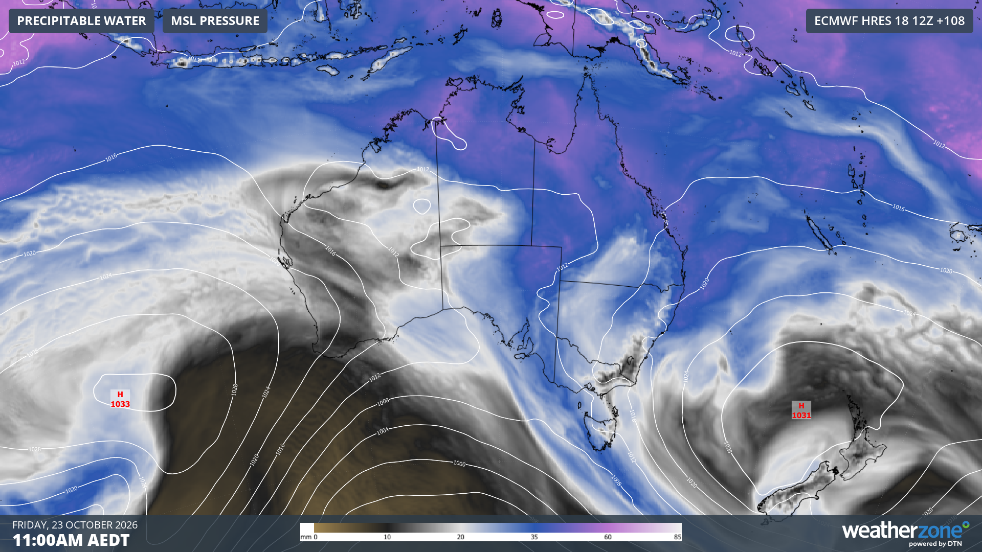
Image: Modelled mean sea level and precipitable water at 11 am AEDT on Friday, October 23, 2026, showing the same high pressure system still centred above the Tasman Sea.
A high pressure system centred over the Tasman Sea typically causes the following weather in Australia:
- Onshore winds over eastern Australia, which often enhance rain and thunderstorm activity over parts of Queensland and NSW.
- Northerly winds over southern Australia, allowing warm inland air to flow towards the country’s southern and southeastern states.
- Hot conditions in northwestern Australia.
This week will feature all three of the features listed above and because the high will be near stationary for around six days, the weather will be repetitive from day-to-day for many areas in eastern and southeastern Australia.
Rain and thunderstorms in eastern Australia
Widespread showers and thunderstorms will affect parts of Queensland and NSW every day this week.
There are signs that a two-day period of heavy rain could develop over southeast Queensland and northeast NSW on Thursday and Friday as an upper-level trough crosses the region. As this burst of heavy rain could occur during a prolonged period of wet and stormy weather, there would be a heightened risk of flooding if forecast rain totals eventuate.
Some computer models predict that parts of southeast Queensland and northeast NSW could see 100 – 200 mm of rain this week. If this happens, it would be equivalent to roughly two months of October rainfall in some areas.
Showers and thunderstorm activity will also affect parts of every other state and territory in Australia this week. This will partially be caused by the moisture being pushed towards Australia from the east by the high over the Tasman Sea, but also in response to moisture-laden air flowing over Australia from the Indian Ocean. Warmer-than-average sea surface temperatures in the Tasman Sea and Indian Ocean will also contribute to this week’s widespread rainfall in Australia.
The map below shows how much rain one computer model is predicting across the country this week. This is not likely to be exactly how it will play out, but it gives a good indication of where the heaviest rain is currently expected to occur, and how widespread rainfall could be across Australia.
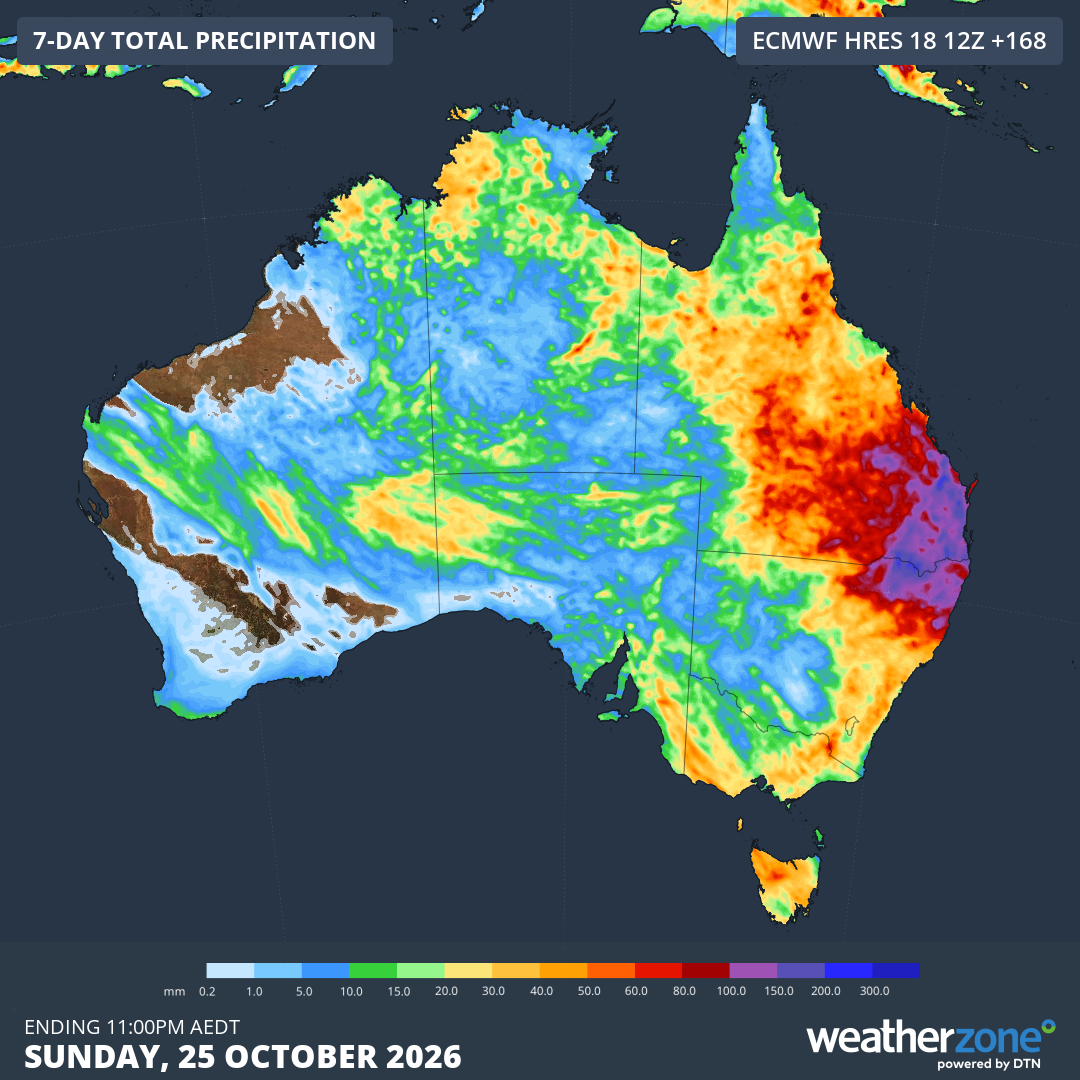
Image: Forecast accumulated rain during the 7 days ending at 11 pm AEDT on Sunday, October 25, 2026. Source: Weatherzone.
Hot air spreading towards southern Australia
Northerly winds on the western flank of the Tasman Sea high pressure system will draw warm air from central Australia towards the country’s south and southeast this week.
This weather pattern will create a unique situation where Hobart’s daily maximum temperatures will be higher than Brisbane’s maximums for much of the week. This is unusual became Hobart’s average maximum temperature in October is 10°C cooler than Brisbane’s.
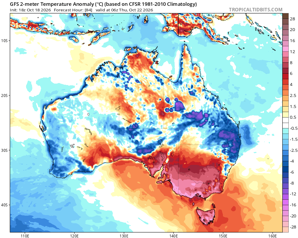
Image: Forecast temperature anomaly at 11 am AEDT on Thursday, October 22, 2026. Source: TropicalTidbits.com.
Melbourne and Adelaide are both forecast to have their first 30°C days of spring this week, while Hobart is forecast to reach the mid to high twenties every day from Monday to Friday, well above the city’s October average maximum temperature of 17°C.
More extreme heat will occur in northwestern Australia at the start of this week as a hot air mass sits over the north of WA on Monday and Tuesday. As of 11 am AWST on Monday, temperatures had already reached as high as 44.6°C at Mandora.
When will the weather pattern change?
The high pressure system centred over the Tasman Sea is expected to move to the east of New Zealand from Sunday into early next week.
This departing high is expected to make way for a cold front to sweep across southern Australia, which will likely cause another burst of rain and storms over large parts of the Australian continent from Sunday into early next week. There are even early signs that cold air could bring a dusting of spring snow to parts of southeastern Australia around Monday next week if enough cold air accompanies the front.