
Why has southeast Queensland seen so much rain this week?
Close to 300 mm of rain has fallen in parts of southeast Queensland between Wednesday morning and Thursday afternoon. This deluge has broken October records and caused dangerous flash flooding. So, why has there been so much rain in the last couple of days?
There are three main ingredients needed for heavy rain and thunderstorms:
- Moisture
- Atmospheric instability
- Trigger mechanism
Moisture sources converging over eastern Australia
The main ingredient you need for heavy rain is moisture and this has been available in abundance over southern Queensland and northern NSW in the last two days.
Two separate moisture sources are converging over eastern Australia this week. One is coming from the Indian Ocean and flowing across Australia from the west, providing moisture-laden air in the middle and upper levels of the atmosphere. Another stream of moisture is also flowing over Australia from the east, transporting atmospheric moisture from the Coral and Tasman Seas towards eastern Australia.
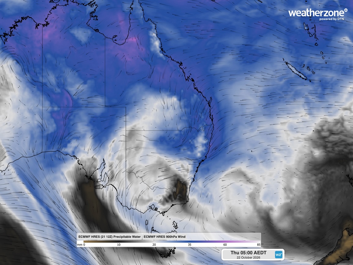
Image: Precipitable water and 850 hPa winds at 5 pm AEDT on Thursday, October 22, 2026. Source: Weatherzone.
A weather balloon released from Brisbane Airport on Thursday morning showed that the atmosphere was loaded with moisture from the ground all the way up to about 9 km above the surface. This deep layer of atmospheric moisture is providing ample fuel for sustained and heavy rainfall in southeast Queensland and northeast NSW.
Upper-level low providing instability
A slow-moving upper-level low pressure system is located over northern NSW on Thursday. This system is associated with a pool of relatively cold air in the upper atmosphere. When cold air sits above warmer air, it causes atmospheric instability that encourages air to lift. This lifting helps create the towering clouds needed to produce heavy rain and thunderstorms.
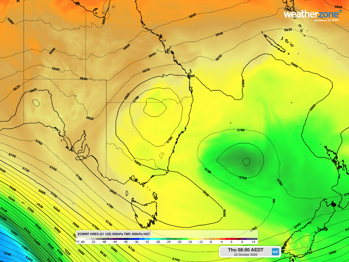
Image: 500 hPa temperature and height, showing an upper-level low over northern NSW on Thursday morning. Source: Weatherzone.
The movement of the upper-level low over the last two days has also helped draw a fresh pool of moisture-laden air towards southeast Queensland, which is one of the reasons why rainfall intensified so rapidly on Wednesday night into Thursday morning.
Troughs and terrain providing triggers
When the atmosphere is unstable and loaded with moisture, all that is needed for heavy rain and thunderstorms to occur is a trigger – something that causes air near the surface to start rising.
Numerous low pressure troughs sitting near the surface have acted as triggers over the last couple of days. The terrain in southeast Queensland and northeast NSW has also acted as a trigger by forcing winds to rise over the many hills and mountains across the region.
Slow-moving systems
One other ingredient that has helped make this week’s rain so heavy is the slow-moving nature of the showers and storms.
The winds that have been pushing the clouds and rain across southeast Queensland and northeast NSW – known as steering winds – have been relatively weak over the last two days. This has meant that areas of heavy rain have been able to sit over one area for a prolonged period.
In some cases, a phenomenon known as ‘training’ has also allowed repetitive areas of heavy rain to track over the same area. Training occurs when multiple storms move over the same location in a sequence, like train carriages moving along a track.
The combination of slow-moving storms and training has resulted in some exceptionally large rainfall accumulations over several hours.
One rain gauge near Caboolture registered more than 170 mm of rain in three hours on Thursday morning. Rainfall of this intensity can easily overwhelm drainage systems and trigger flash flooding. Beerburrum also received 170.8 mm in the 24 hours ending at 9am on Thursday, which was a new daily record for October at the site.
Combining the rain that fell from 9am on Wednesday to 2 pm AEST on Thursday, some areas have received close to 300 mm. This includes preliminary totals of 290 mm at Caboolture Water Treatment Plant and 268 mm at Sheep Station Creek.