
Weekend of wild weather for NSW and Vic
It has been a wild weekend of heavy rain and severe thunderstorms for Victoria and NSW, only one of which gets to enjoy a long weekend.
As forecast by the Weatherzone team on Friday and Saturday, thunderstorms developed across a broad area of NSW and the ACT associated with a low pressure system over the southwest of the state. Severe thunderstorms also tore through the greater Sydney area producing flash-flooding, large hail, while further south, a short-lived small tornado was spotted at Ulladulla.
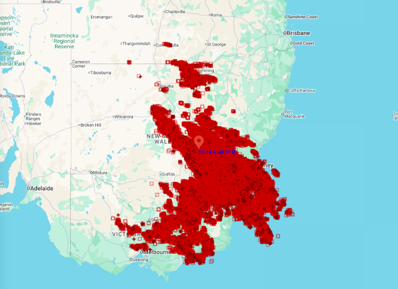
Image: Nearly 400,000 lightning strikes detected over NSW and Victoria during Saturday 3rd October, according to the DTN Total Lightning Network. Source: Weatherzone
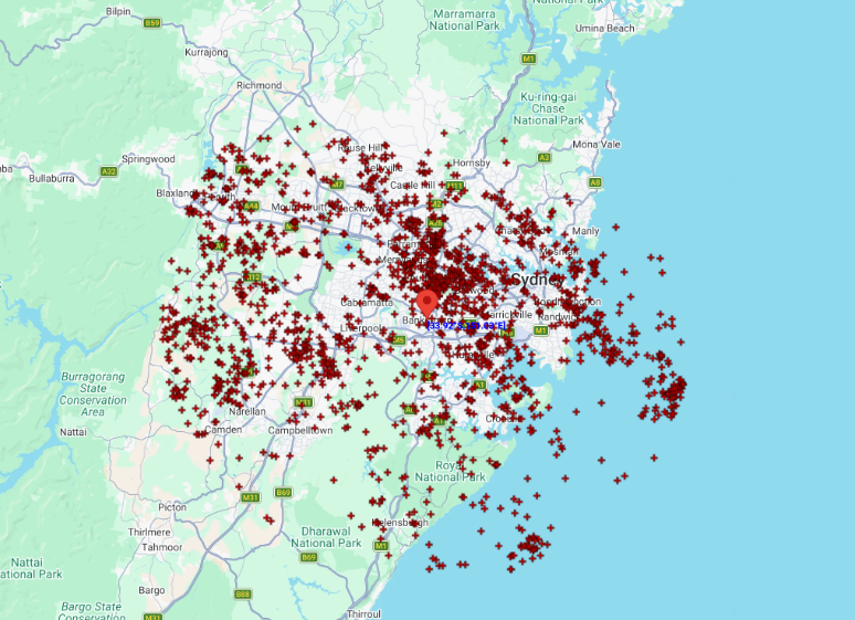
Image: Nearly 2000 ground lightning strikes detected within a 40 km radius of Bankstown during Saturday 3rd October, according to the DTN Total Lightning Network. Source: Weatherzone
DTN Total Lightning Network registered 1,885 cloud to ground lightning strikes within 40km of Bankstown during all of Saturday 3rd October. More broadly across southeast Australia, there were about 392,000 lightning strikes, including both cloud-to-cloud and cloud-to-ground strikes, detected over NSW and Victoria during the same period.
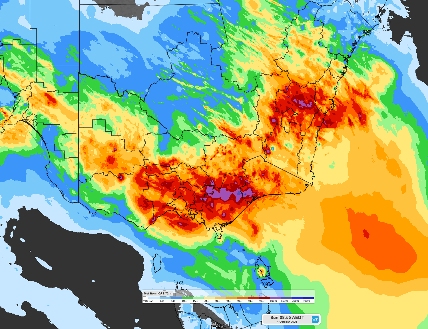
Image: Estimated observed rainfall for the 72 hour period ending 9am October 4th 2026. Source: Weatherzone
The same low pressure system gave Victoria a much welcome drenching after parts of the state recorded its second driest September on record, almost as if the atmosphere realised that October had just ticked over. Much of Victoria and southeast NSW recorded 50-100mm over the 3-day period ending 9am Sunday 4th October, with West and South Gippsland and the Otway Ranges recording the most.
The highest 3-day totals were:
- 175.8mm at Mt Moornapa, just inland of Bairnsdale.
- 138.0mm at Mt Cowley in the Otway Ranges
- 125.2mm at Thredbo Top Station in the NSW Alpine area.
- 123.7mm at Mt Baw Baw in Victoria.
- 115.2mm at Balook to the southeast of the Latrobe Valley in Victoria.
This has led to a number of flood warnings for Victoria, including a Major Flood Warning for the Thompson River.
And for those playing at home, Melbourne recorded 64.0mm over 3 days which is its wettest 3-day period in October for 74 years.
The low pressure system has now moved east over the Tasman Sea. Much more settled weather is expected for NSW for the remainder of the weekend and for the start of the working week in Victoria.
You can keep up to date with weather warnings impacting you here: https://www.weatherzone.com/au/warnings