
Queensland to face more heavy rain and severe thunderstorms this week
Rain and thunderstorms could affect parts of Queensland every day this week, with severe storms and flooding a significant risk based on current forecasts.
Last week, intense rainfall caused flash flooding as parts of the state’s southeast were inundated with more than 300 mm of rain in 48 hours, with some places receiving more than 170 mm in just three hours.
More rain and storms on Monday
This week has already started with further torrential rain thanks to storms passing over southeast Queensland early on Monday morning. These storms delivered close to 100 mm in a matter of hours, including:
- 98 mm in 4 hours at Tarome
- 75 mm in 3 hours at Upper Goomburra
- 68 mm in 3 hours at Millbrook
Computer models suggest that further thunderstorm activity will affect a broad area of Queensland on Monday, most likely from the central inland down to the state’s southeast.
Some of Monday’s storms are likely to become severe, with damaging winds, large hail and heavy rain all possible. Conditions may also support supercell thunderstorms capable of bringing destructive winds (greater than 125 km/h) and giant hail (greater than 5 cm diameter) over parts of central and southeast Queensland on Monday afternoon and early evening.
Stormy weather continuing this week
The atmosphere is likely to be unstable enough to support thunderstorms over parts of Queensland every day this week.
On Tuesday, the areas that are most likely to see showers and storms will be northwest, central and southeast Queensland.
The wet and stormy weather is expected to contract further north from the middle of the week, mainly impacting northern and central Queensland on Wednesday and Thursday.
Later in the week, an eastward-moving low pressure trough could cause showers and thunderstorms to become more intense from Friday into the weekend, while also possibly spreading across southern parts of the state. Some computer models indicate that parts of central Queensland could see heavy rain around Friday as an area of converging winds becomes established over the state.
The maps below show how much rain three different computer models are predicting during this week. While there is some disagreement regarding rainfall intensity, all three maps highlight central Queensland as a region that should see some of the heaviest rain this week.
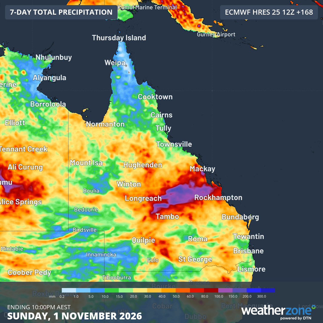
Image: Forecast accumulated rain during the 7 days ending at 10 pm AEST on Sunday, November 1, 2026, according to the ECMWF model. Source: Weatherzone.
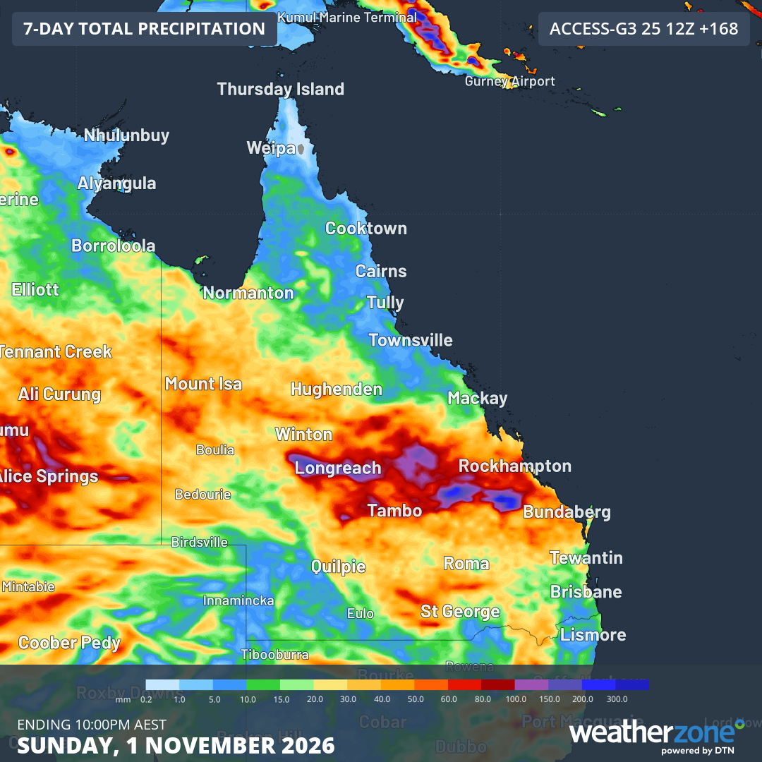
Image: Forecast accumulated rain during the 7 days ending at 10 pm AEST on Sunday, November 1, 2026, according to the ACCESS-G model. Source: Weatherzone.
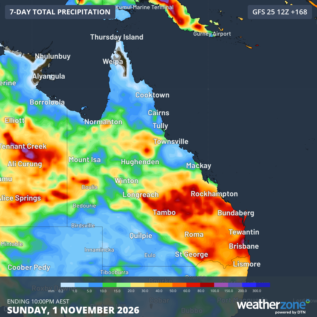
Image: Forecast accumulated rain during the 7 days ending at 10 pm AEST on Sunday, November 1, 2026, according to the GFS model. Source: Weatherzone.
How to keep track of severe weather this week
There is a high chance of severe weather over parts of Queensland this week, most likely including severe thunderstorms and flash flooding.
While computer models are useful to highlight which parts of the state will have the necessary ingredients for this severe weather and thunderstorm activity, it’s difficult to know exactly where the most intense rain and storms will occur.
More reliable information will become available each day as satellites and radar towers start to observe weather as it is happening. This information will be used by the Bureau of Meteorology to monitor conditions as they develop and issue warnings where necessary.
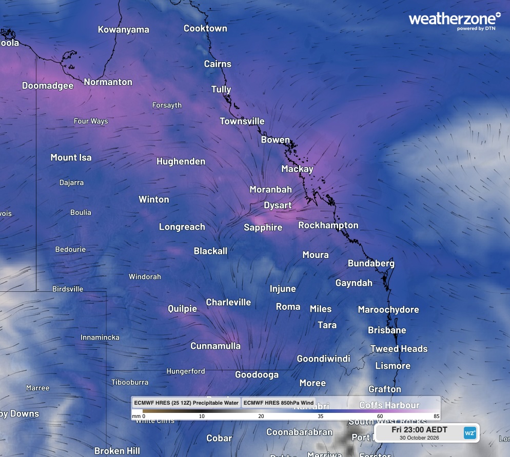
Image: Modelled precipitable water and 850 hPa wind at 11 pm AEDT on Friday, October 30, 2026, showing moisture-laden winds converging over central Queensland, which could create a focal point for rainfall. Source: Weatherzone.
Pay close attention to the mention of rain and thunderstorms in your local forecasts throughout the week, keeping in mind that these forecasts usually update multiple times each day.
As rain and storms begin to develop, look at radar and satellite images to track rain and storms in near-real time. Also regularly check the latest severe weather and severe thunderstorm warnings in your area throughout the week.
When severe weather is occurring, emergency services advise people to:
- Never drive, walk, play or ride through floodwater.
- Stay away from storm water drains.
- Stay away from fallen powerlines.
Drive slowly and never drive through floodwaters. If the road is flooded or damaged, go another way.
For emergency assistance call SES on 132 500. In life-threatening emergencies, call 000 (triple zero) immediately.