
Wintry blast to bring snow, storms and large waves to southeastern Australia this weekend
A burst of cold, wet and windy weather will spread across parts of Victoria, Tasmania, NSW and the ACT this weekend, with snow likely to fall in three states as large waves batter the NSW coast.
While summer is less than four weeks away in Australia, this weekend will serve up a taste of winter-like weather as a cold front surges across southeastern Australia.
The front will reach Tasmania on Friday before crossing Victoria on Friday night into Saturday morning, then passing over NSW and the ACT on Saturday.
Tasmania
Rain and blustery westerly winds will spread across Tasmania on Friday and persist on Saturday. The heaviest rain will fall in the state’s west and south, where onshore winds will interact with the state’s mountainous terrain, possibly causing around 10–30 mm of rain on Friday and Saturday combined.
The cold snap should see snow settling in parts of central, western and southern Tasmania on Friday night and Saturday. Snow is expected to start falling above 800 metres elevation on Friday evening and could reach down to around 500 metres by Saturday morning.
A Bush Walkers Weather Alert has been issued for parts of Tasmania’s Western and Central Plateau districts, where conditions will be hazardous due to cold temperatures and settling snow on Friday night and Saturday.
Hobart is forecast to reach a maximum of only 14°C on Saturday, which is about 5°C below average for a November day.
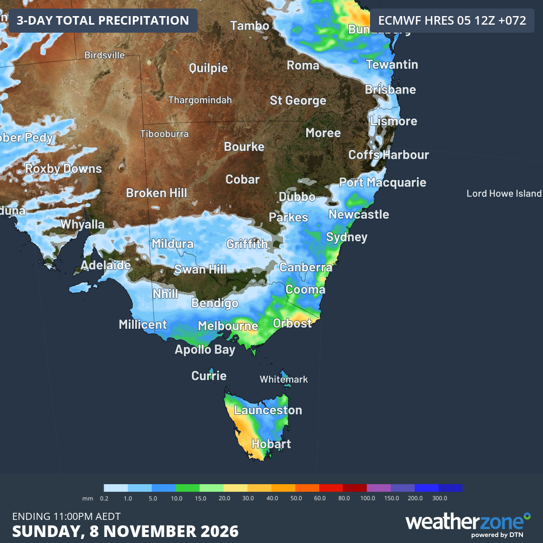
Image: Forecast accumulated rain over southeastern Australia for the three-day period ending on Sunday night. Source: Weatherzone.
Victoria
Showers and blustery winds will spread across Victoria on Friday night and Saturday as the cold front passes over the state. Most of the rain associated with this system will be confined to the state’s south and east.
Showers could fall as snow on the state’s eastern ranges on Saturday, possibly as low as 800 metres. Some areas in southern Vic may also see small hail among Saturday’s showers.
Melbourne’s temperature is forecast to reach around 15°C on Saturday, although most of the day will feel cooler than 8°C due to wind chill.
NSW and the ACT
The cold front will enter southern NSW and the ACT on Saturday morning before spreading northward across NSW throughout the day and reaching the state’s northeast at night.
Showers will affect some southern, central and eastern parts of NSW and the ACT on Saturday, with thunderstorms also possible in the east. Storms are most likely to develop near the southerly change as it moves towards the north throughout the day. Severe thunderstorms are possible between the South Coast and Mid North Coast, including Sydney, Wollongong, the Central Coast and Newcastle.
Snow is also likely in the NSW alps on Saturday, possibly reaching about 800 metres elevation in the afternoon and early evening.
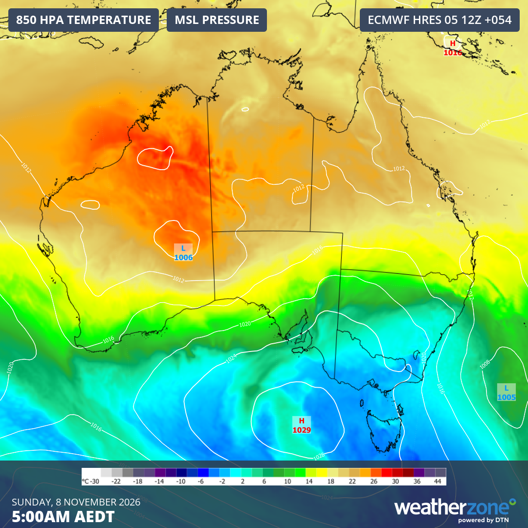
Image: Forecast 850 hPa temperature and mean sea level pressure at 5 am AEDT on Sunday, November 8, showing cold air spreading over southeastern Australia as a low pressure system develops over the Tasman Sea. Source: Weatherzone.
Sydney is likely to see a sharp temperature drop on Saturday as the southerly change blasts through the city. The mercury could climb to around 30°C in the city before the southerly arrives and causes the temperature to dive sometime between about 2–5 pm. The temperature could drop by more than 10°C in an hour or two when the southerly change arrives.
Sunday will remain cool and showery along the NSW coast as blustery southerly winds persist. The city’s temperature is expected to feel lower than 10°C throughout Sunday.
Large waves are also expected to develop along the NSW coast on Sunday as a low pressure system develops over the Tasman Sea. Waves could reach around 2–3 metres, with the largest waves expected to impact south-facing beaches.