
Why northern Australia is enduring a long-running heatwave
A huge swathe of northern Australia is enduring an extended period of heatwave conditions, with maximum and minimum temperatures well above average for this time of year.
Here's a quick overview of how hot it has been, how long the heatwave will last, and the causes of the unusually warm conditions.
How can such a consistently hot region have a heatwave?
The BoM defines a heatwave as a period when maximum and minimum temperatures are unusually hot over three days, as compared to the local climate and past weather.
So hot locations in northern or outback Australia can absolutely have heatwaves, just as places with relatively mild climates like Hobart can. It's all about the temperatures relative to normal.
Temperatures during the current heatwave at two key locations
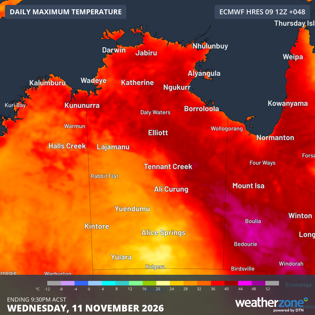
Image: Forecast maximums across the NT and nearby parts of adjacent states for Wednesday, November 11, 2026 (according to the ECMWF model), showing the locations of Darwin and Weipa. Source: Weatherzone.
Let's take a look at the recent temperatures, and the forecast temperatures over the next few days, in Darwin (NT) and Weipa (the largest town on Queensland's Cape York Peninsula).
Darwin
- Darwin averages just 3.1 days of 35°C or higher during November.
- But the NT capital has just had a run of 7 days of 35°C or higher, with another five on the forecast from this Tuesday, November 10 – potentially a 12-day streak.
- If Darwin reaches 35°C over 12 consecutive days, that would be the city's longest November run with maximums of 35°C or higher since 1929.
- Minimums have also been warm by local standards. Nine of the 10 mornings so far this November have exceeded the average monthly low of 25.3°C, with minimums around 27°C or 28°C likely over the next seven days.
Weipa
- The largest town on Cape York Peninsula, Weipa averages a maximum of 36.0°C in November, but that has been comfortably exceeded every day to date this month.
- Weipa had its hottest November day in 54 years of records with a high of 39.8°C on Saturday.
- Maximums around 38°C or 39°C are forecast for the next seven days.
- Minimums around 24°C or 25°C are forecast over the next seven days (the November average is 23.6°C)
So what is the cause of the current heatwave in these areas?
Weatherzone meteorologist Ben Domensino says the current heatwave can be attributed to the combined influence of El Niño, a positive Indian Ocean Dipole (IOD) and above-average sea surface temperatures around the Top End and other parts of northern Australia.
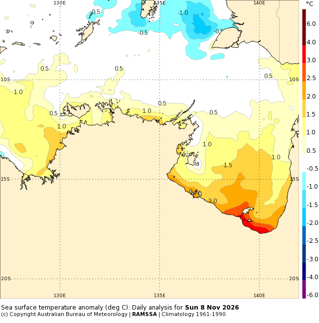
Image: Sea surface temperature anomalies for waters off the NT and nearby parts of Qld and WA on November 8, 2026. Source: BoM.
Warmer-than-average sea surface temperatures help create warmer-than-average air temperatures over land. This is because the air absorbs some of the heat from the water surface before moving inland.
Without going into detail on the atmospheric dynamics associated with broad-scale climate drivers, the key point is that both El Niño and a positive IOD tend to reduce cloud cover over northern Australia, which generally leads to much warmer daytime temperatures.
Erratic and sluggish start to the wet season
The current hot, mostly dry spell reflects the fact that much of Australia's far north has experienced a very slow start to the 2026 wet season.
To return to our examples of Darwin and Weipa:
Darwin had just under half its monthly rainfall in September and October, and has thus far had only one meaningful rain day in November, with 25.4 mm on November 8.
That wet Sunday brought Darwin's rainfall total since September 1 beyond 50 mm – a crucial threshold which technically means the "build-up" is over and the wet season has officially begun. But there remains no sign of the regular, near-daily showers and thunderstorms that mark the wet season.
Weipa has had almost no rain since April, including just 0.8 mm so far this November in a month in which it averages 90.4 mm. The current spell of heat shows no signs of waning just yet.
According to Ben Domensino, the monsoon is expected to be delayed this season, which could see these abnormally warm conditions extending into late December or even early January.