
Warm weather to continue across the UK after autumn equinox
The Autumnal Equinox takes place in the early hours of Wednesday morning UK-time, which marks the end of astronomical summer. For meteorologists, the transition to autumn takes place on September 1. Either way, the atmosphere pays little attention to the calendar, with above-average temperatures likely to persist in many parts of the UK over the next week or two.
Warm conditions likely
A highly amplified – or wavy – jet stream will influence the weather over the UK and mainland Europe during the next week or two. Overall, this will lead to above-average temperatures across a wide area, as blocking areas of high pressure develop from time to time.
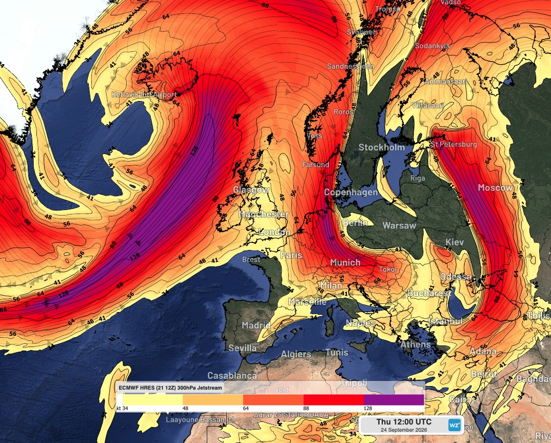
Image: Jet stream winds (300 hPa) over the UK region on September 24, 2026. Source: Weatherzone.
Temperatures across southern parts of the UK should climb into the mid-20s Celsius at times, whilst France is likely to reach the low 30s.
Wetter weather in some areas
The UK is likely to see more rain than many parts of mainland Europe during the next two weeks, as frontal systems will affect the islands. Western and northern areas may end up rather wet, but the south-east of the UK will be somewhat drier. However, a few thunderstorms are possible from time to time across this area, after a relatively quiet warm season for thunderstorms.
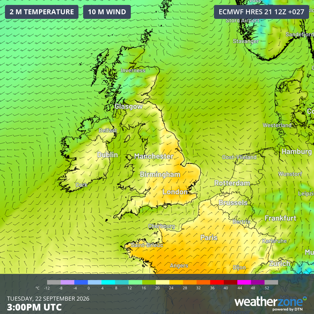
Image: Forecast air temperature and wind at 3 pm UTC on Tuesday, December 22, 2026. Source: Weatherzone.
As the calendar ticks over into October, there are no signs of any early-season cold outbreaks across north-western parts of Europe. Despite autumn's arrival on the calendar, temperatures are expected to remain above average across much of the UK through late September.