
Two past weather events on this Day, 14th November
Sunday 14th November 2021
On this day in 2021, a strong cold front swept across Victoria, bringing damaging wind gusts, cold showery conditions and frequent thunderstorms along the state's south coast.
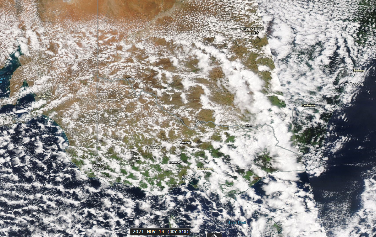
Image: Visible satellite image for Sunday afternoon on 14th November 2021. Courtesy of NASA Worldview
Wind gusts peaked at 130 km/h at Wilsons Promontory. The destructive winds damaged numerous properties and left hundreds of homes without power.
Behind the cold front, a cold airmass brought a taste of winter to the Victorian and New South Wales Alpine regions. Temperatures remained below zero at several locations, with snow falling across the higher Alps.
Maximum temperatures recorded at Alpine resorts:
- Falls Creek (Summit): –1.4°C
- Mount Buller (Summit): –0.6°C
- Thredbo Village: 4.5°C
- Top of Crackenback: –1.9°C
- Perisher Valley (Resort Base): 0.4°C
In Melbourne, the maximum temperature reached 15.3°C on Sunday 14th November, before dropping further to just 13.8°C on Monday 15th November.
Thursday, 14th November 2025
High temperatures and moist north to north-easterly winds fuelled thunderstorm activity across eastern Queensland, with severe thunderstorms developing over southeast Queensland during the afternoon and evening.
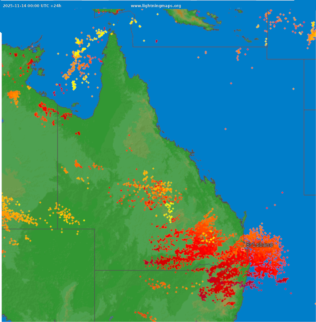
Image: Lightning strikes over 24 hours to midnight 14th November. Courtesy of Blitzortung.org and contributors and LightningMaps.org
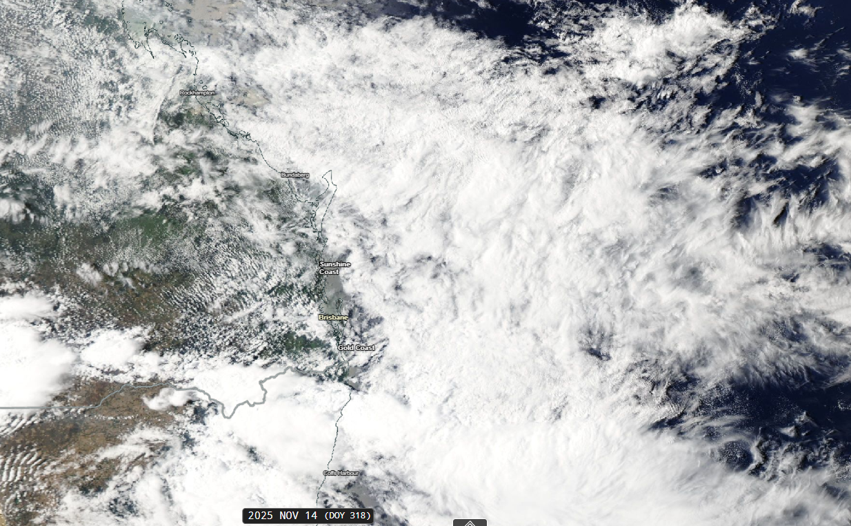
Image: Visible satellite image for Thursday afternoon on 14th November 2025. Courtesy of NASA Worldview
A line of severe thunderstorms swept across Brisbane and surrounding areas in the late afternoon and early evening, bringing damaging winds, heavy rainfall and large hail.
Some notable observations included:
- Nambour: Wind gusts reached 91 km/h during the evening.
- Mitchelton: 48 mm of rain fell in just 30 minutes during the early evening.
- Clontarf: Hailstones measuring 3–4 cm in diameter were reported during the early evening.
Severe thunderstorms also developed across central Queensland, prompting Bureau of Meteorology warnings for damaging winds and flash flooding.
Further inland, Wallumbilla, near Roma, recorded 41 mm of rainfall in 30 minutes by the early evening.
Meanwhile, northwesterly winds drove temperatures into the low 40s across western and southwestern Queensland. Maximum temperatures included 41.4°C at Boulia, 40.5°C at Winton and 40.0°C at Longreach.