
Storms brewing across SA and Victoria
Thunderstorms have swept across South Australia today, with more storms forecast through the afternoon and evening. The same system is now spreading into Victoria, where thunderstorms are beginning to develop.
A trough moving through the region will provide the spark for storm development, with some thunderstorms expected to become severe, bringing the risk of damaging winds, large hail and intense bursts of rain that may lead to flash flooding. Keep an eye out for warnings in your area.
Thunderstorms have already developed across large parts of SA this morning, with lightning reaching the suburbs of Adelaide over lunchtime, with 4282 lightning strikes recorded in the 50km around the city. Further thunderstorms are expected to develop this afternoon and evening across SA and extending east into Victoria.
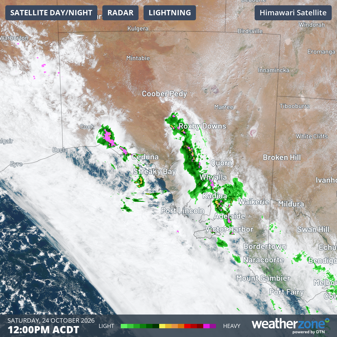
Image: Satellite image with radar on Saturday 24th October, 2026, 12 pm ACDT. Source: Weatherzone
Spring is typically one of the most active thunderstorm seasons across southeastern Australia, with today's outbreak driven by a combination of warm air, moisture and atmospheric instability – favourable conditions for thunderstorm development.
Rainfall expected with these thunderstorms is expected to be extremely variable, with some locations receiving only a few millimetres and others recording heavy falls in a short period of time. For instance, Ceduna on South Australia's west coast, recorded almost 9mm in one hour from 2 pm to 3 pm ACDT today, whilst Adelaide West Terrace has recorded 4.6mm since 9 am this morning. As thunderstorms continue to develop tonight, some locations could see rainfall totals climb rapidly, with the heaviest storms capable of producing intense downpours that may lead to localised flash flooding.
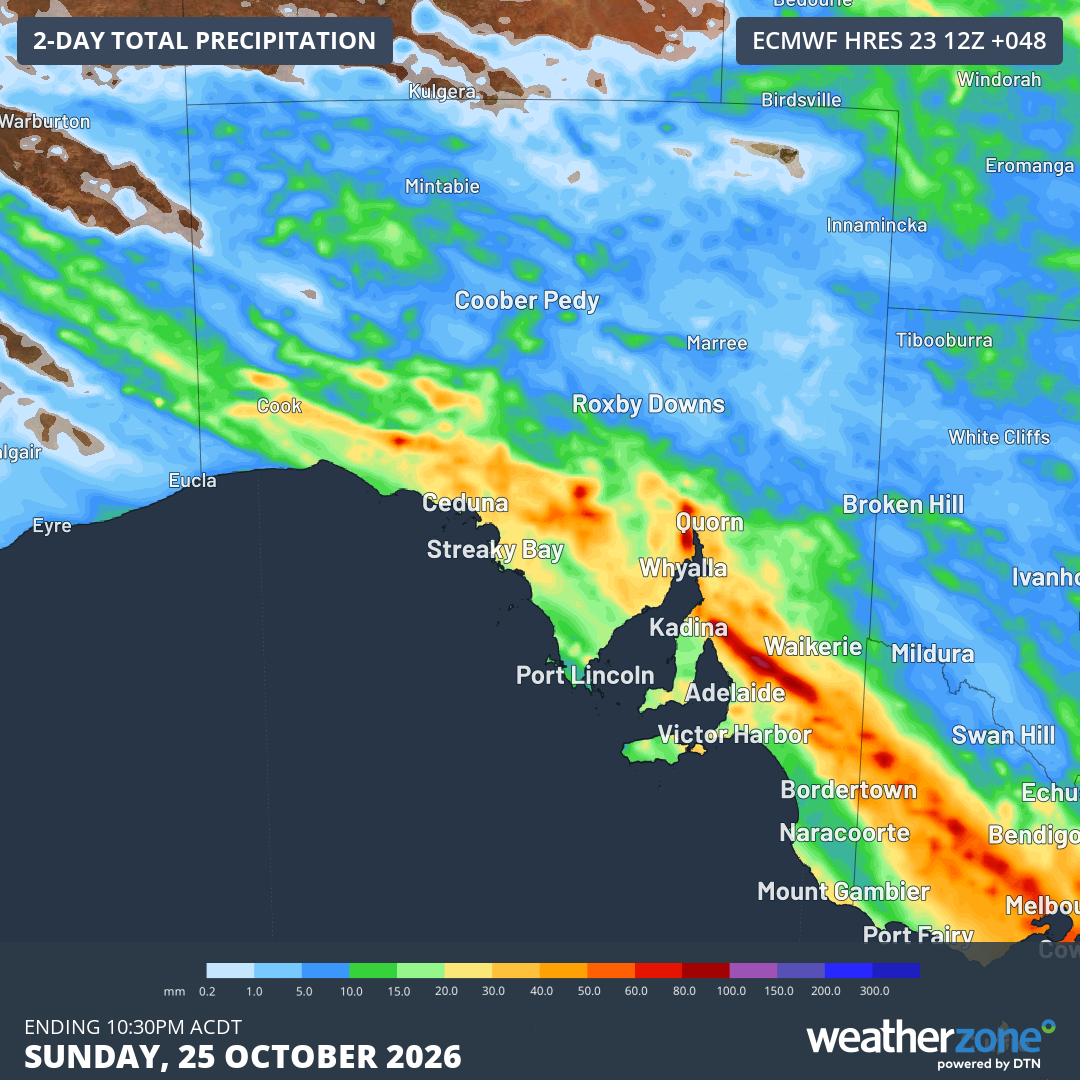
Image: Rainfall accumulation over 48 hours for South Australia and Victoria, ending Sunday evening, according to the ECMWF model. Source: Weatherzone
Given that conditions can vary dramatically over short distances, it is important to stay up to date with the latest forecasts and warnings through the weekend.