
Storm Bruna batters Spain and Portugal as Storm Charles threatens further severe weather
Parts of the Iberian Peninsula are being affected by severe weather associated with Storm Bruna, with another system – Charles – possibly on the way to bring further wind, rain and storms later in the week.
The jet stream across the North Atlantic region is rather to the south of its usual position at the moment. This has led to quiescent conditions across parts of north-west Europe. Conversely, south-western Europe is enduring some rather stormy conditions, with bouts of wind and rain affecting Spain and Portugal.
Storm Bruna causing severe weather
Storm Bruna has brought impacts across the Iberian Peninsula over the last two days. Madeira has been hardest hit so far, with wind gusts reportedly topping 80mph. These triggered more than 100 emergency incidents, forcing the closure of major Funchal tunnels, cancelling dozens of flights, and displacing some residents from flooded homes.
The Canary Islands have also been affected. Wind gusts up to 70 mph downed trees and road signs across Tenerife, caused one minor injury in La Palma, and forced seven flight diversions over the weekend.
Mainland Spain and Portugal are now being affected by heavy rain, thunderstorms, and brisk winds. These will continue through this week, with some places forecast to have 150–200 mm of rainfall over the next five days.
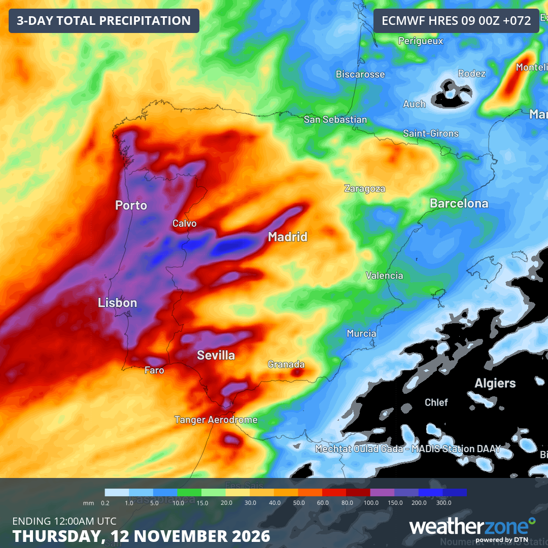
Image: Forecast accumulated rain during the 72 hours ending at 12:00 am UTC on Thursday, November 12, 2026. Source: Weatherzone.
Charles on the horizon
There are strong signals that another area of low pressure – a ‘secondary low’ forming on the southern side of Bruna – will rapidly develop during Tuesday and Wednesday, bringing the risk of stormy conditions to southern Spain and Portugal. This storm has been named Charles by AEMET, the Spanish weather service.
Currently, some weather models are showing the risk of 70-80mph winds in a few spots. However, these rather extreme values are dependent on how rapidly the storm intensifies.
As well as wind and rain across the area this week, very large waves are expected across the Atlantic coastal areas, perhaps up to 4-5 metres.
Looking further ahead, it looks like the jet stream will tend to reform further to the north into next week, with north-west Europe potentially seeing an uptick in wind and rain chances – a rather more normal set-up for the time of year.