
Snow, hail, freezing winds coming to southeastern Australia
A two-pronged wintry burst is brewing in the Southern Ocean and surging towards southeastern Australia.
Rain, hail, gusty winds, and snow in elevated areas are all part of the mix as two distinct cold fronts cross the southeast in a weather pattern more reminiscent of midwinter than late spring.
First cold front arrives Wednesday into Thursday
The first cold front has already brought chilly conditions on Wednesday morning to parts of South Australia, with Mount Lofty in the Adelaide Hills registering a temperature of just 9.9°C at 11 am (ACDT) while Adelaide itself was a cool 16.5°C under southwesterly winds.
While Melbourne should reach 23°C this Wednesday in the slightly warmer air mass ahead of the front, a cooler top of 18°C is forecast for Thursday in the wake of the front.
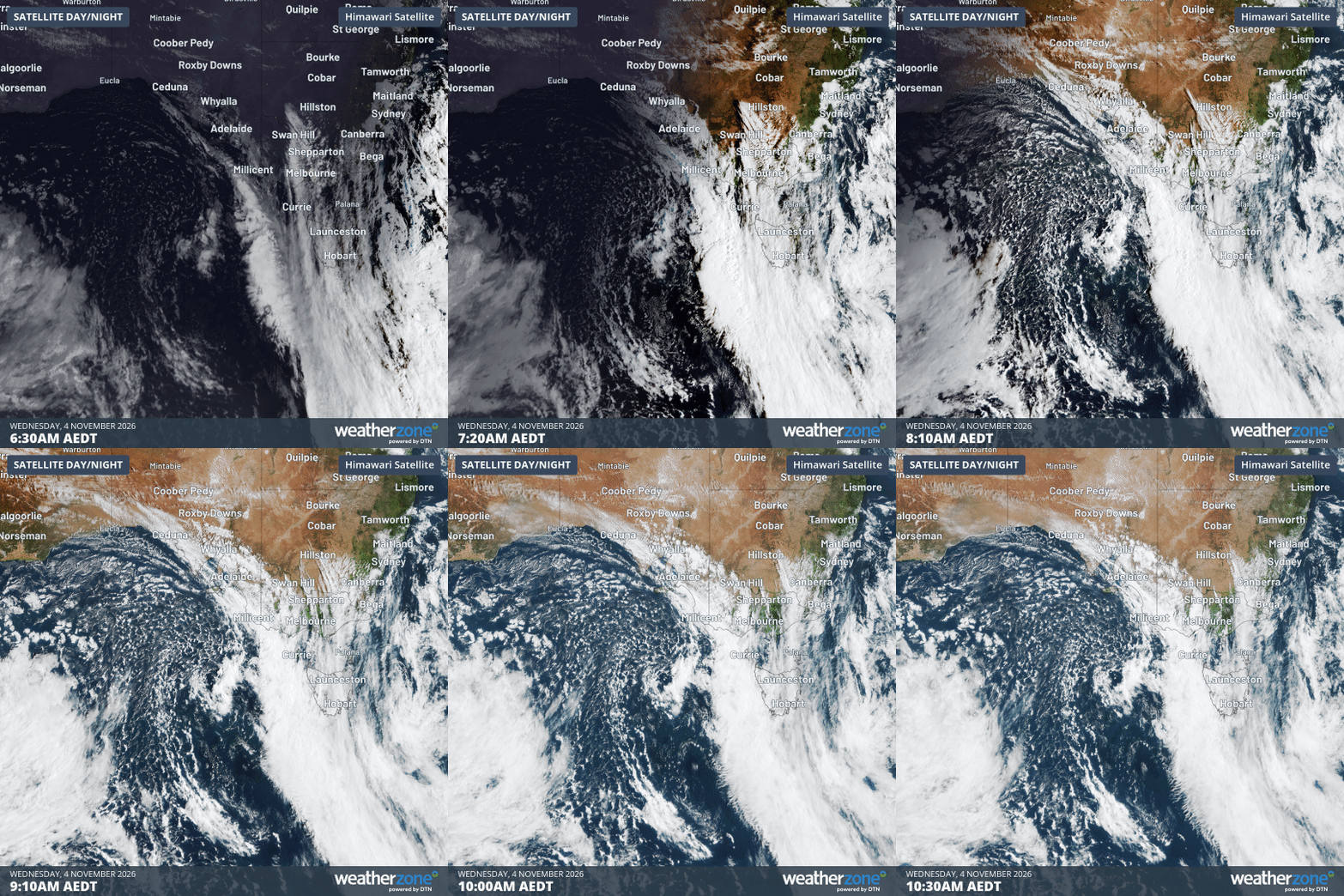
Image: Four-hour satellite loop to 10:30 am (AEDT) showing the cloudband ahead of the first cold front and a speckled air mass indicating cold air behind it over the eastern Great Australian Bight. Source: Weatherzone.
Interestingly, the loop above shows the coldest air in the first cold front tracking mostly north of Tasmania, which helps explain why Hobart is expecting a maximum of 20°C on Thursday – two degrees warmer than Melbourne's.
"Melbourne will be in a southerly all day on Thursday, while Hobart will have westerly winds flowing down from the mountains," Weatherzone meteorologist Ben Domensino explains.
"This flow will be warmer because it's coming from land instead of water and also likely warming up a bit due to the Foehn effect [the natural phenomenon of air becoming warmer and drier as it descends to a lower altitude]."
But on Saturday, both Hobart and Melbourne (and plenty of other spots) will be absolutely frigid as the second cold front makes its presence felt.
Bitterly cold in Melbourne and Hobart on Saturday
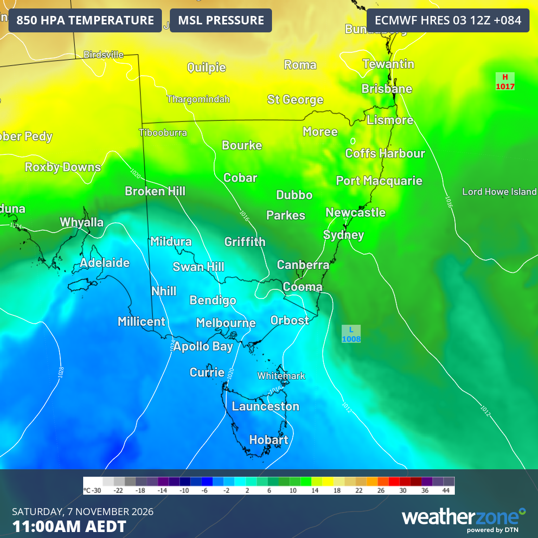
Image: 850 hPa temperatures and mean sea level pressure predicted for 11 am (AEDT) on Saturday, November 7, 2026. Source: Weatherzone.
As the second, stronger cold front arrives on Friday into the weekend, Melbourne is expected to reach a maximum around just 14°C on Saturday.
For perspective, the city's average November maximum is 22.0°C while the average maximums in the winter months of June, July and August are 14.1°C, 13.5°C and 15.0°C respectively.
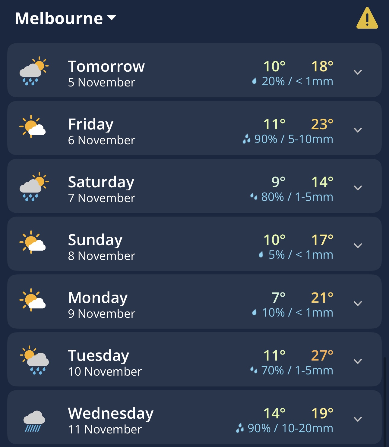
Image: 7-day forecast for Mebourne, Vic, on the Weatherzone app.
Hobart is also expected to reach just 14°C on Saturday (its average November maximum is 18.8°C).
Showers will accompany the influx of cold air in both cities, and small hail is a distinct possibility in many Melbourne suburbs.
Snow in Tasmania and the mainland high country
Snow is forecast to fall at elevations which would be considered low for snowflakes even in midwinter, with a predicted Saturday snow level of 400 metres in parts of Tasmania, and 800 to 900 metres in the NSW and Victorian high country.
While snowfalls in elevated parts of southeastern Australia at this time of year are infrequent, they are not unusual.
In most cases, the snow melts within a day or so, however it would still be very wise to reconsider any outdoors plans in mountainous regions this weekend.
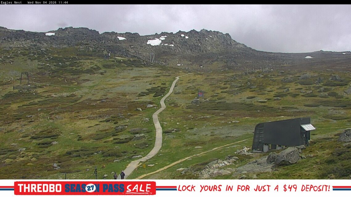
Image: A few remnant patches of winter snow are still visible above Thredbo on the trail to Mt Kosciuszko on the morning of November 4, 2026. Source: ski.com.au.