
Smoke from New Guinea fires reaches northern Australia
A large plume of smoke originating from seasonal fires burning in New Guinea has drifted over the Northern Territory's Top End this week.
Images captured by the Himawari-9 satellite over the last few days show smoke gradually spreading from New Guinea towards northern Australia. By Tuesday morning, the smoke was extending roughly 1000 km from New Guinea to the Top End.
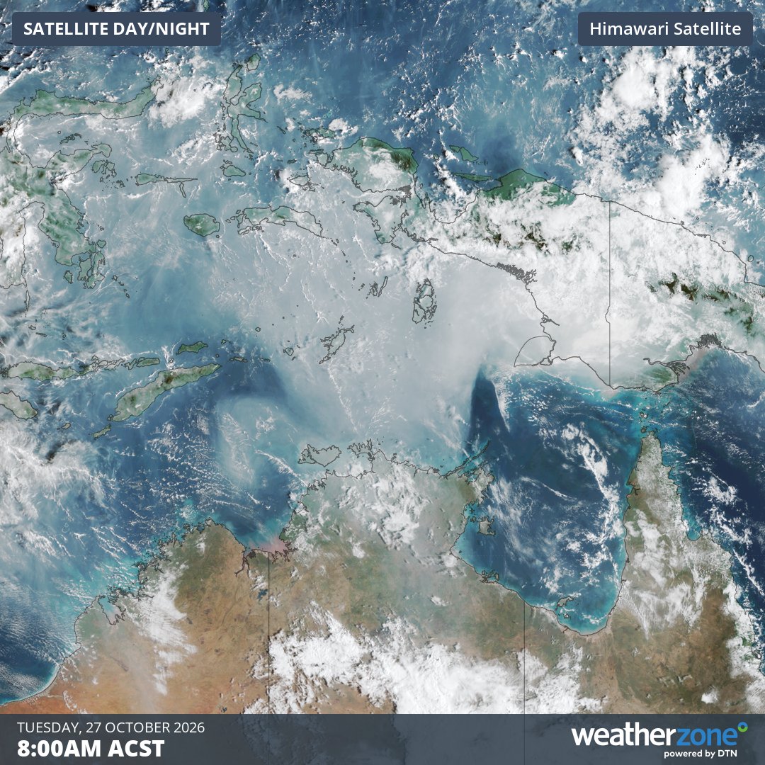
Image: Visible satellite image showing smoke extending from New Guinea to the Top End on Tuesday morning. Source: Weatherzone.
The high-level smoke is not having any direct impact at the surface in the NT. However, the large size of the smoke plume showcases the immense scale of the fires that have been scorching parts of Indonesia and Papua New Guinea in recent weeks and months.
While fires are a regular occurrence in Indonesia and Papua New Guinea between August and November, this year’s blazes have been enhanced by abnormally dry conditions under the influence of El Niño.
Some areas in the south of Papua New Guinea have gone more than 100 days without any rainfall, according to the PNG National Weather Service.
The map below shows that large areas of Indonesia and Papua New Guinea have seen less than 10% of their average rainfall over the past 90 days.
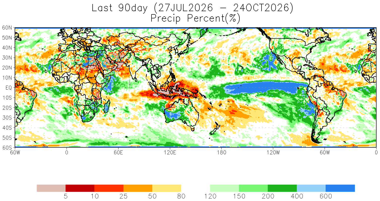
Image: Percentage of average precipitation during the 90-day period ending on October 24, 2026. Source: NOAA.
According to NASA, this season’s fires in Papua New Guinea had released 32 megatons of carbon by October 17, which is the highest year-to-date total in NASA’s satellite record. Indonesia’s 35 megatons of fire-driven carbon emissions to the same date were also the highest since 2015 (also an El Niño year).
Increasing shower and thunderstorm activity has helped reduce fire activity over parts of Indonesia and Papua New Guinea in recent weeks. However, fire activity is expected to remain active until heavier and more persistent monsoonal rain arrives later in the year.