
Severe thunderstorms could bring giant hail, destructive winds and flash flooding to eastern Australia on Tuesday
Parts of Queensland and NSW will likely be impacted by severe thunderstorms on Tuesday, with destructive winds, giant hail and flash flooding all possible.
An upper-level trough passing over eastern Australia on Tuesday will cause the atmosphere to become unstable enough to support widespread thunderstorm activity over parts of Queensland, NSW, the ACT and Victoria.
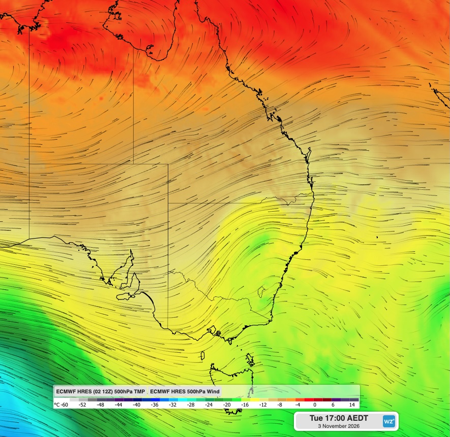
Image: Modelled 500 hPa wind and temperature at 5 pm AEDT on Tuesday, November 3, 2026, showing an upper-level trough over eastern Australia. Source: Weatherzone.
Tuesday’s outbreak of showers and thunderstorms will extend roughly 2000 km from central Queensland to eastern Victoria, possibly including Brisbane, Sydney and Canberra.
A focus area for more intense storms will be over central and southeast Queensland and northeast NSW, where increased wind shear – changing wind speed and direction with height – may cause very dangerous supercell thunderstorms to develop during the afternoon and evening.
Supercells are the most dangerous type of thunderstorm. They are capable of lasting for several hours and typically produce violent weather that can include very heavy rainfall, destructive wind gusts (exceeding 125 km/h) and giant hail (greater than 5 cm diameter). Some supercells can also cause tornadoes.
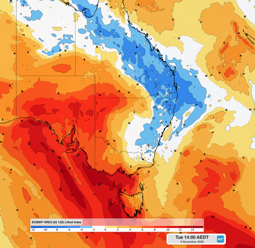
Image: Lifted index over eastern Australia at 2 pm AEDT on Tuesday, November 3, 2026. This is a measure of atmospheric instability. Areas with negative lifted index values are more likely to see thunderstorm activity. Source: Weatherzone.
It’s not possible to predict exactly where severe thunderstorms or supercells will develop on Tuesday. However, the area stretching from Queensland’s Central Highlands and Coalfields down to about Sydney, including southeast Queensland and northeast NSW, is where severe storms are most likely to occur during Tuesday.
The highest risk of supercells on Tuesday will be between central Queensland and the Mid North Coast in NSW, including southeast Queensland. If any tornadoes do occur on Tuesday, they will be very localised compared to the rain, hail and wind impacts that are more likely to occur across this region.
With three capital cities and numerous other densely populated areas at risk of severe thunderstorms on Tuesday, millions of Australians may be affected by this dangerous storm outbreak.
Anyone in eastern Australia on Tuesday should keep up to date with the latest severe thunderstorm warnings. Checking the radar throughout the day will also help stay on top of developing showers and thunderstorms.
For emergency help in severe weather, including flooding and thunderstorms, ring the SES on 132 500. In life-threatening emergencies, call 000 (triple zero) immediately.