
Severe thunderstorm warnings issued across three states as volatile weather continues
Warnings for severe thunderstorms were issued in parts of Queensland, New South Wales and Victoria on Friday, continuing a volatile two days of stormy weather in eastern and southern Australia.
An upper-level trough passing over southeastern Australia this week has caused widespread rain and thunderstorm activity on Thursday and Friday.
Parts of South Australia were hit by violent storms on Thursday afternoon as the upper-level trough started moving across southern Australia. One particularly intense storm cell damaged electricity transmission towers on the state’s Eyre Peninsula, cutting the power supply to thousands of residents.
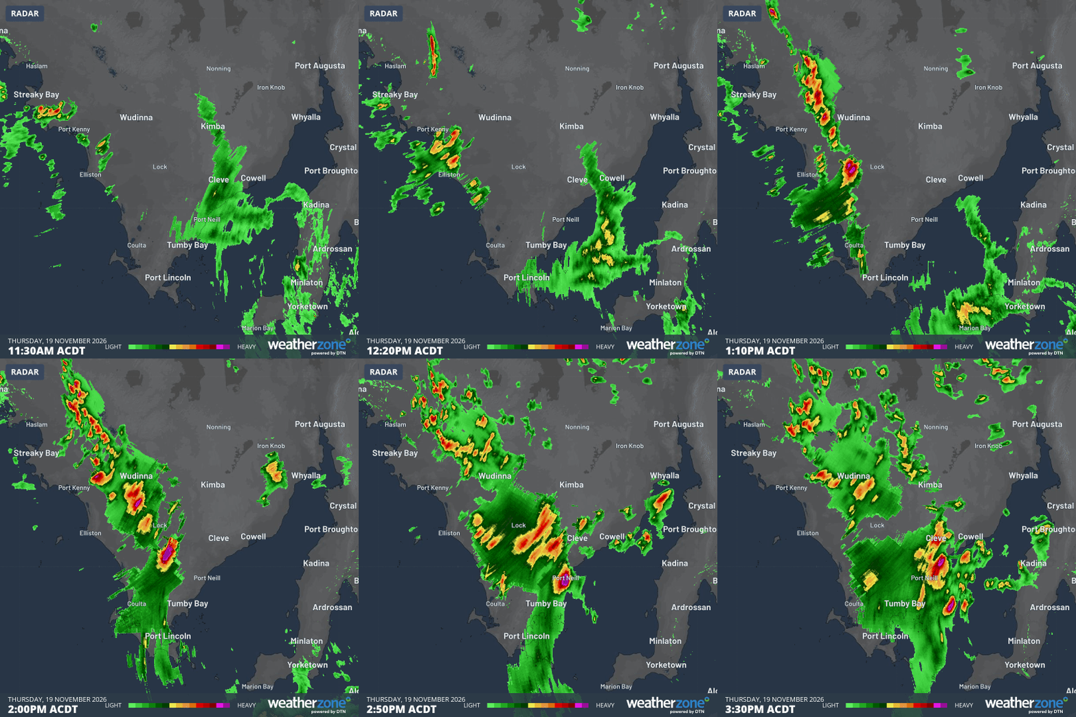
Image: Radar images showing severe thunderstorms moving over SA’s Eyre Peninsula on Thursday, November 19, 2026. Source: Weatherzone.
As the upper-level trough moved east, storms also spread into parts of eastern and southeastern Australia on Thursday and Friday.
Some areas in western NSW received their heaviest rain in around three years during the 24 hours ending at 9am on Friday. This included Bourke’s 70.6 mm, which was also its wettest November day since 1984.
Thunderstorms have been active over parts of Australia’s eastern inland throughout Friday but became more intense and widespread into the afternoon due to the influence of heating from the sun.
In Victoria, a weather station at Dookie near Shepparton received 16 mm in 30 minutes during an intense storm shortly after 4 pm local time on Friday. Another storm dumped 28 mm in one hour at Addington.
As of 5 pm AEDT on Friday, severe thunderstorm warnings were in place for parts of Victoria, western NSW and western Queensland. These dangerous storms are likely to persist into the evening.
Further showers and thunderstorms are expected to affect parts of eastern and southeastern Australia over the weekend, although these storms will generally be less intense and widespread compared to Thursday and Friday.
Looking further ahead, another upper-level trough should bring another round of heavier rain and severe thunderstorms to parts of Queensland and NSW early next week.
Be sure to check the latest severe thunderstorm warnings in your area for the most up-to-date information on active storms over the coming days.