
Severe thunderstorm warnings for giant hail issued for parts of Qld, NSW
A dynamic afternoon and evening of weather is unfolding this Wednesday in South East Queensland and the northeastern corner of New South Wales, with severe thunderstorm warnings issued for both areas.
Queensland warnings
Just before 3:30 pm (AEST), the BoM issued a severe thunderstorm warning for damaging winds, the possibility of giant hailstones and heavy rainfall that may lead to flash flooding for parts of the following council areas:
- Gympie, Logan, Somerset, Scenic Rim, Gold Coast, Redland City, Sunshine Coast, Brisbane City, Moreton Bay, South Burnett, and Toowoomba.
Severe thunderstorm warnings were issued earlier for parts of the following forecast districts:
- Wide Bay and Burnett, Southeast Coast, and Darling Downs and Granite Belt.
New South Wales warnings
Just after 4 pm (AEDT), the BoM issued a severe thunderstorm warning for large, possibly giant hailstones, damaging winds and heavy rainfall that may lead to flash flooding for parts of the following forecast districts:
- Northern Rivers, Mid North Coast, and Northern Tablelands.
What is causing this dynamic storm outbreak?
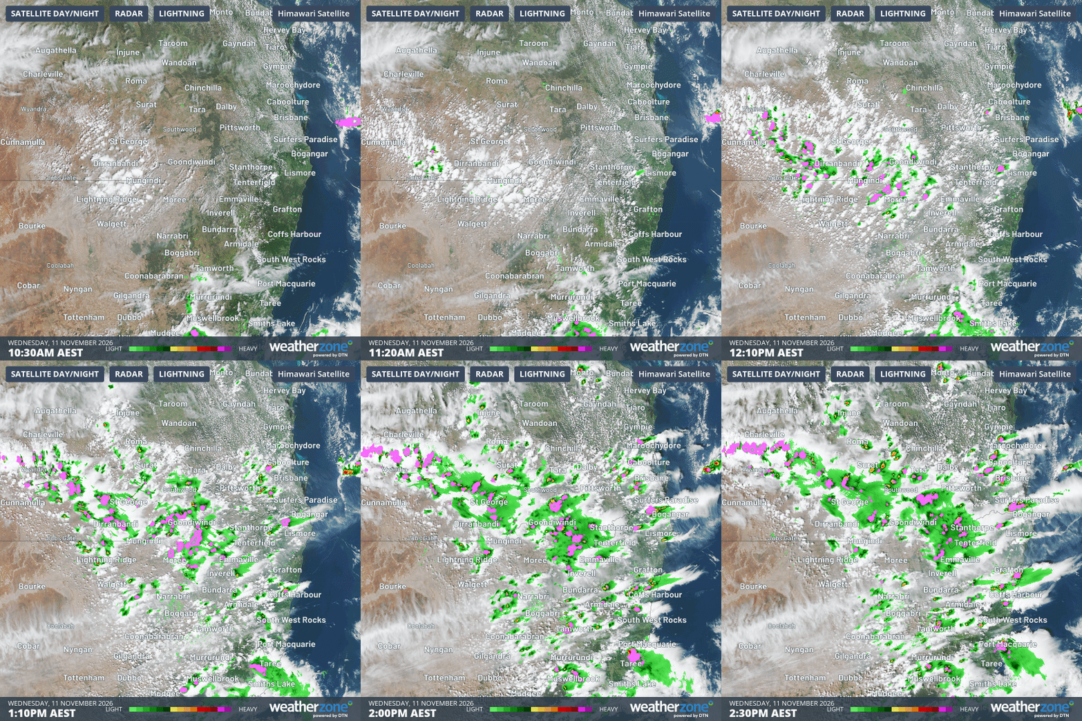
Image: Four-hour radar and satellite loop to 2:30 pm (AEST) on Wednesday, November 11, 2026, in SE Qld and NE NSW showing the rapid development of thunderstorms. Source: Weatherzone.
As the loop above shows, the storms organised quickly on Wednesday afternoon after a relatively clear morning.
The storms developed as the border region heated rapidly with many locations reaching 30°C before midday. As Weatherzone meteorologist Joel Pippard explains, "a surface trough helped force the hot and humid surface air upwards into a cool, unstable upper atmosphere."
This is an evolving situation so please check the Weatherzone warnings page for the latest information. And for emergency assistance during floods or storms, please contact the NSW SES or the Queensland SES.
Safety advice for storms
- Ensure that children are with you or an adult you trust.
- Stay away from windows if there is giant hail.
- Park your car undercover away from trees.
- Close doors and windows.
- Keep asthma medications close by, as storms and wind can trigger asthma attacks.
- Charge mobile phones and power banks in case the power goes out.
- Put your pets somewhere safe and make sure they can be identified in case they get lost.
- Do not drive unless essential.
- Tell friends, family and neighbours in the area.
- Stay inside a strong building until the storm has passed.