
Severe storms coming for WA
Thunderstorms have arrived on the west coast of Western Australia, kicking off a multi-day spell of wet and stormy weather that will affect a broad area of the state during the next four to five days.
Friday's first light revealed large masses of cloud over the Indian Ocean to the west of Western Australia.
This large area of clouds, and the showers and thunderstorms they contain, will spread over Western Australia between now and Tuesday next week.
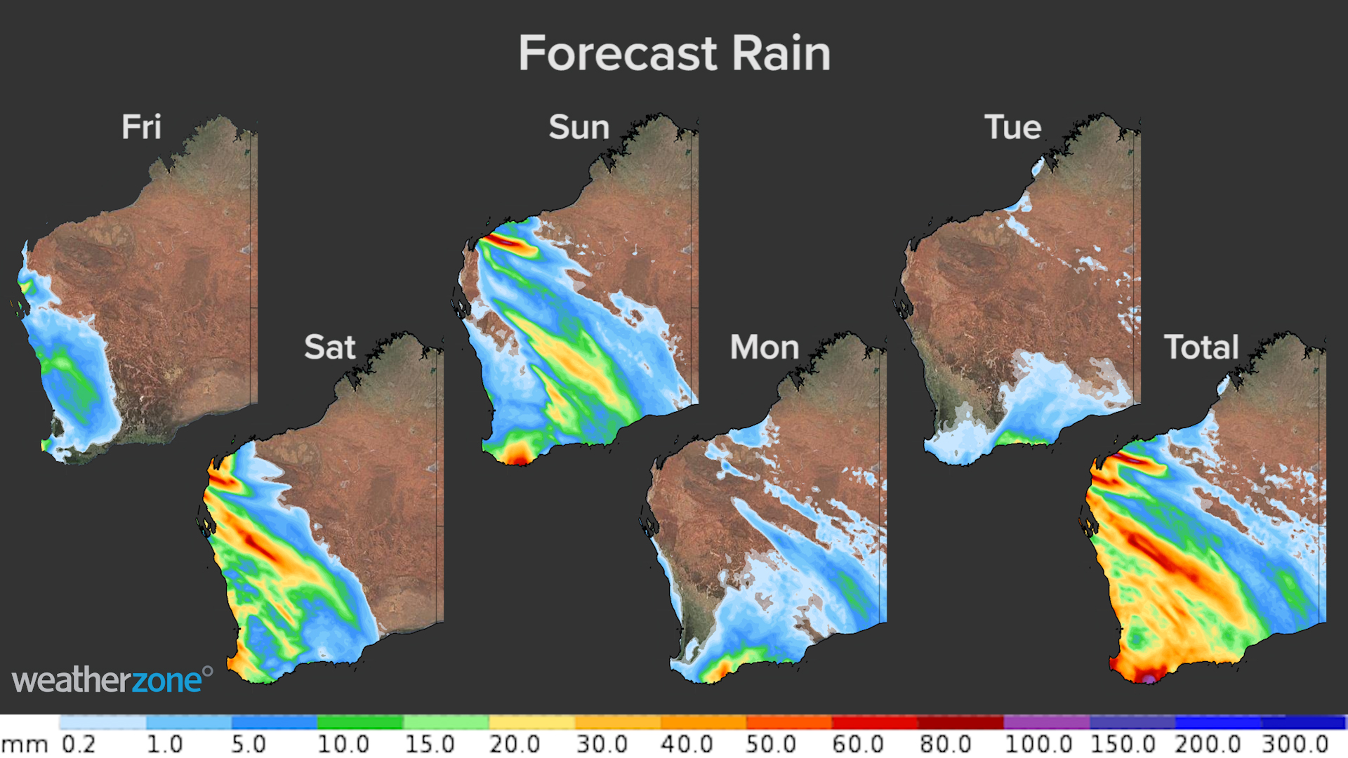
Image: Forecast rain for each day between Friday, May 28 and Tuesday, June 1, according to the ECMWF-HRES model. The final map shows the total accumulated rain across the five days.
On Friday, showers and storms will initially affect the state's central western districts, before spreading further south and east towards Perth and across the wheatbelt in the afternoon and evening.
Some of these storms could become severe. Some showers and thunderstorms will continue through Friday night into early Saturday morning, before becoming more widespread and intense over the state's western, central and southern districts on Saturday.
Storms are possible over parts of every district in Western Australia except for the Kimberley and North Interior on Saturday, with severe storms likely in many areas.
By Sunday, the system will split into a low pressure system near the state's southwest and a trough extending from the Pilbara down to the Eucla. Showers and some storms will continue near the trough in parts of the Pilbara, Gascoyne, Goldfields, South Interior and Eucla districts. Showers and storms will also continue to affect western and southern parts of the South West Land Division, including Perth.
As we head into the new week, showers should contract to the state's south coast and adjacent inland on Monday and Tuesday, as the low pressure system starts moving into the Bight. There could also be a few lingering showers and thunderstorms over the Eucla, Interior and Pilbara near the weakening trough.
The most dangerous weather from this complex system for most places will occur on Friday and Saturday. Be sure to keep up to date with the latest forecasts and warnings over the next few days.