
Rain and thunderstorms spread across NSW and Queensland
Wet and stormy weather is spreading across eastern Australia this Tuesday, October 13, bringing welcome rain to parts of NSW and Queensland along with a risk of severe storms into the evening.
A low pressure trough interacting with tropical moisture and an unstable atmosphere is creating favourable conditions for widespread showers and thunderstorms over parts of NSW and Qld this Tuesday. This is the same trough that caused storms in central Australia on Monday, bringing hail and flash flooding to Alice Springs.
Tuesday’s storms are bringing heavy rain to parts of NSW and Qld. Shortly after lunchtime, Moree in northern NSW received 8 mm of rain in less than one hour, while Tamworth collected about 7 mm in 10 minutes.
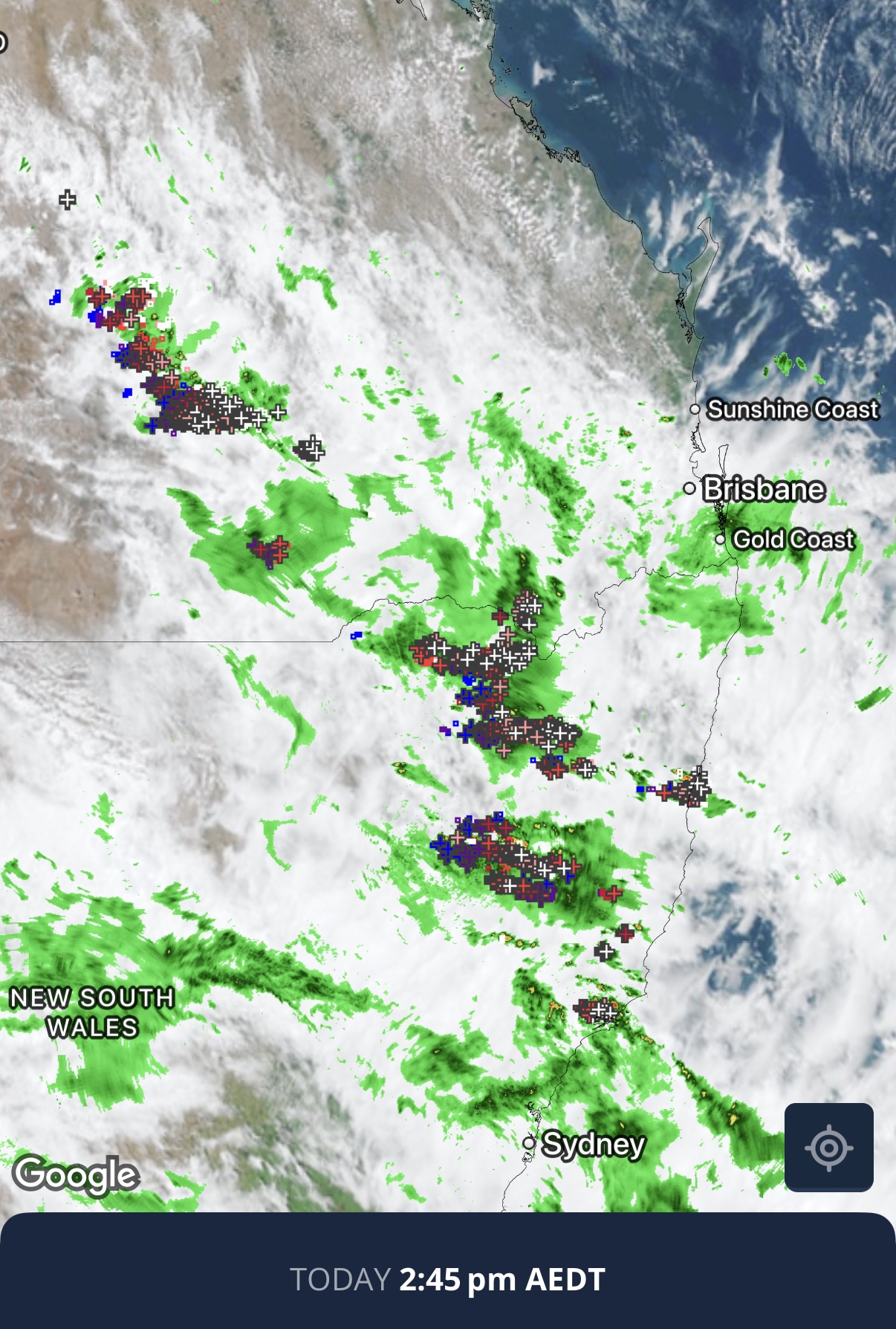
Image: Composite satellite, radar and lightning strikes on the Weatherzone app, showing thunderstorms over eastern Australia on Tuesday afternoon. Source: Weatherzone.
The eastward progression of the trough will cause rain and thunderstorms to spread towards the coast on Tuesday afternoon and evening. This could include areas of heavy rain and potentially severe thunderstorms in parts of northeast NSW and southeast Qld.
There is potential for thunderstorms to sweep across Brisbane and other areas of southeast Qld on Tuesday evening. These storms are not guaranteed due to cloud cover suppressing temperatures during the day, which could hinder storm development into the afternoon and evening. However, if storms do get going, they may become organised and have a risk of becoming severe.
Welcome rain after lengthy dry spell
Despite the risk of lightning and severe storms, this rain is likely to be welcome across areas of NSW and Qld that have been unusually dry in recent weeks.
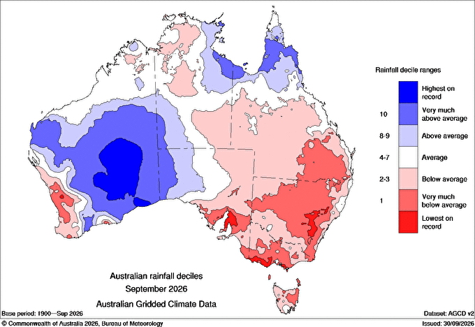
Image: Observed rainfall deciles during September 2026, showing below-average rainfall over large areas of Qld, NSW and southeastern Australia. Source: Bureau of Meteorology.
Last month, rainfall was in the lowest 10% of historical September totals across a broad area of NSW and southern Qld, with some areas in central NSW having their driest September on record.
This week will see multiple rounds of rain and thunderstorms affecting eastern Australia, bringing some relief to these parched areas of NSW and Qld.