
Possible 'sting jet' may have caused Hurricane Isaias’ strongest winds
When Hurricane Isaias hit Florida earlier this month, the strongest winds were observed to the west of the system’s core. This unusual phenomenon – the strongest winds are usually found to the east of a landfalling hurricane – may have been caused by a narrow band of powerful winds called a ‘sting jet’.
Wild winds to the west of Isaias
Hurricane Isaias made landfall as a category 2 hurricane on the evening of October 9, 2026, near Destin, FL.
Typically, the western side of the eyewall in a hurricane is considered the ‘clean side’ with overall weaker winds, lower storm surge, less heavy rain, and few tornadoes.
However, observations on the western side of Hurricane Isaias showed the strongest winds well to the west of the system’s core.
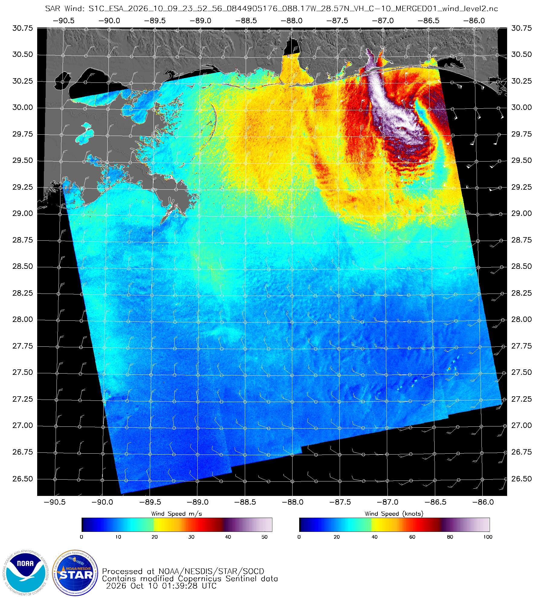
Image: Synthetic Aperture Radar (SAR) image, showing wind speed derived from the roughness of the water. The image shows the eye of Isais offshore with peak winds in the 80 to 100+ knot range to the west of the system’s core. Source: NOAA STAR SOCD.
Sting jet a possible cause
In the Post Tropical Cyclone Report from the Mobile/Pensacola Office, the highest observed wind gusts from Isaias reached 102 knots (118mph) at Jay, FL, 101 knots (116mph) at Oriole Beach, FL, and 99 knots (114mph) at Whiting Field South, FL.
One possible explanation for these winds is a sting jet, a localised stream of powerful winds that can develop within the jet streak of some intense low-pressure systems before descending towards the surface. When a sting jet reaches the ground, it can generate a narrow corridor of destructive wind gusts capable of causing significant damage.
When looking at satellite imagery, a sting jet can be identified by a hook-shaped cloud with a point on the end, similar to that of a stinger on a scorpion’s tail.
The National Weather Service and National Hurricane Center will continue to analyze post-storm data to determine if these significantly higher wind gusts were caused by a sting jet.