
Late-season heatwave to blanket the West
A prolonged period of unusual warmth is in store for the western US as a strong upper-level ridge settles in during the coming week.
Record highs possible
It may be getting late in the year, but this can still be described as a heatwave for many areas. Temperatures are going to be above or well above the October average widely across the West, challenging records as they rise 10 to 15 degrees F above normal in some locations, or even a bit higher.
Maximum temperatures in Phoenix and downtown Los Angeles, for example, will reach the mid to high 90s F and may touch 100 degrees between now and at least October 10. Parts of southern Oregon could also creep into the 90s, with Boise predicted to reach the mid to upper 80s.
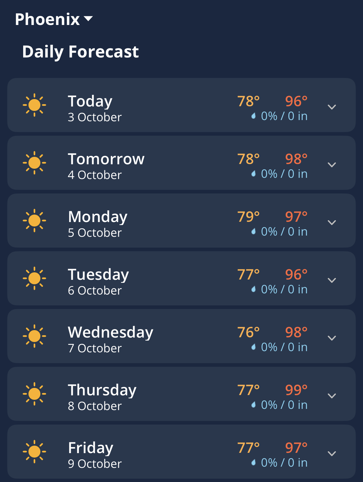
Image: Daily forecast for Phoenix in the Weatherzone app. Source: Weatherzone.
It’s not just daytime warmth that will be notable. Overnight lows will also be unusually high for October, particularly for California and the Southwest.
Further east, temperatures are being suppressed across the Central US, and a cooler air mass will work its way across the Great Lakes and through the East into next week.
A persistent pattern
The broad pattern causing the contrasting temperatures across the US will be tough to shift over the coming week. The upper-level ridge across the West is building as a downstream response to a deeper-than-usual Aleutian low pressure circulation and a trough digging southwards over the Pacific.
During El Niño years, it is more probable than usual that such Pacific Trough regimes will develop, and they can be extremely long-lasting. The very strong El Niño events of 1982-83 and 1997-98, for example, were associated with remarkably persistent Pacific Trough patterns.
The current El Niño is very strong already and continues to strengthen, with the Nino3.4 region of the equatorial Pacific at record warmth for this stage of its development. As such, it is the primary driver of current weather patterns and will continue to overwhelm other influences, such as the Madden-Julian Oscillation (MJO).
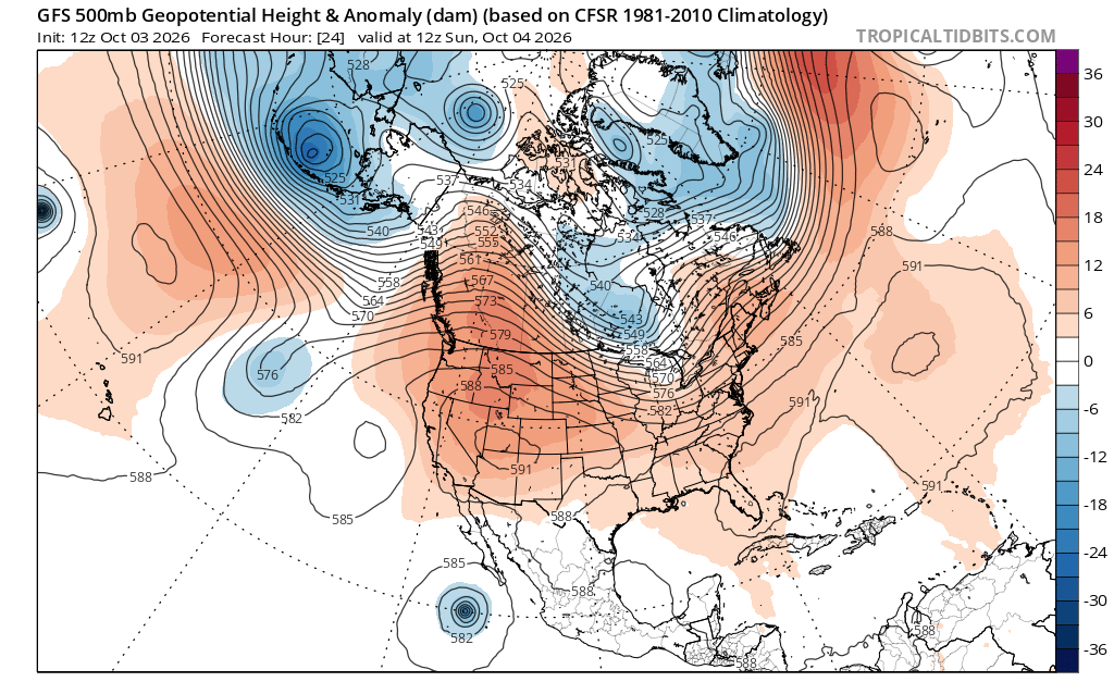
Image: 500hPa anomaly on Sunday, October 4, 2026, showing a strong upper-level ridge over the West. Source: Tropical Tidbits.
Some temperature moderation by mid-October
Next week, temperatures across the Central US should rise above normal as well, as some lesser warmth slowly spreads eastwards beyond the Mississippi Valley. The greatest warm anomalies will probably be from SoCal through the Great Basin to the Central Plains. Meanwhile, a lingering trough downstream will make the East Coast cooler, with near to slightly-below-average temperatures.
There is little sign of this pattern getting substantially disrupted in the next couple of weeks. However, the strength of the upper ridge may ease, with temperatures consequently moderating despite staying above the October mean, probably through mid-October.