
Hurricane Nolo threatens Hawaii with flooding
Past the average peak of hurricane season, the Atlantic Ocean remains abnormally quiet. Tropical Storm Fay and Tropical Storm Gonzalo have formed but are both forecast to soon weaken. By contrast, the Pacific Ocean is a hotbed of hurricane activity, fuelled by the warm waters of El Niño.
A trio of Pacific hurricanes
An active pattern continues in the Pacific Ocean, induced by very warm waters and a lack of disruptive wind shear. Three hurricanes are lined up across the central and eastern Pacific.
From east to west, the first is Major Hurricane Polo, near southwestern Mexico. This is forecast to move away from shore but recurve across southern Baja California early next week. It will then weaken but boost moisture content across the southwestern US, amplifying the monsoon rains and increasing risks of flash flooding around the Four Corners by midweek.
Farther west is Major Hurricane Odalys, but this is expected to steadily weaken as it tracks northeast or northwards across open waters. Before midweek it should just be a depression, with its path becoming more uncertain.
A third system – Hurricane Nolo – is still intensifying to the south of Hawaii. Forecast tracks take it broadly northwards, approaching the Big Island as a major hurricane on Sunday. It may make a sharp turn away onto a more west to northwesterly path, sparing Hawaii the worst wind impacts.
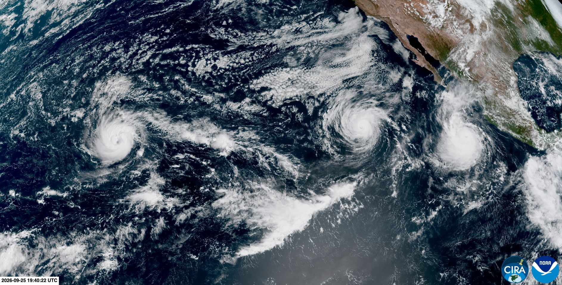
Image: Three hurricanes – Polo, Odlays and Nolo – in the Pacific Ocean on September 25, 2026. Source: RAMMB/CIRA.
Nevertheless, rain will continue to intensify through the weekend, with catastrophic flooding and mudslides possible, especially across Big Island, where up to 36 inches of rain is possible over the mountainous terrain, and Maui, where 20 inches could accumulate. Damaging waves and dangerous storm surge are likely as well. The rest of the state should have less rain but may still see localized flooding.
Yet another tropical depression could form about 1,000 miles east-southeast of Hawaii, but if that happens it should, thankfully, get steered northeastwards over the open ocean.
Western Pacific typhoons
Over in the western North Pacific, Tropical Storm Surigae has developed and should intensify into a typhoon while heading northwest. It should curve to the northeast, skimming past the eastern side of Japan’s Ryukyu Islands, and may be followed by another typhoon developing and taking a similar path in the second half of next week.
El Niño continues to have a strong influence on global tropical cyclone activity, suppressing hurricane development in the Atlantic Ocean and boosting activity in the tropical Pacific.