
Hobart records warmest October in 144 years
October 2026 was Hobart's warmest October in 144 years of records, with both daytime and overnight temperatures reaching record highs.
As mentioned multiple times through the last month, Hobart and Tasmania have experienced exceptional heat throughout much of October, including an early-season heatwave. Hobart was also at times warmer than Brisbane for several consecutive days, some 1,800km to the south of the Queensland capital.
Hobart's hot October
Hobart's official weather station on Ellerslie Road, which has been recording weather data since 1882, reached a maximum of 32.1°C on Friday 23rd, making it the hottest October day since 2006 (when the mercury reached 33.1°C).
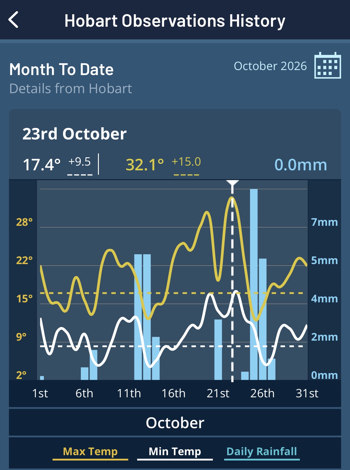
Image: Hobart observation summary for October 2026 highlighting the warmest day of the month on Friday October 23rd as seen on the Weatherzone app. Source: Weatherzone.
In the 144 years of the station's records, October 2026 ranked as the hottest October on record for both minimum (10.0°C) and maximum (20.6°C) temperatures.
Hobart was not the only Tasmanian location to have its warmest October on record, with nearly 30 other observation stations recording either their hottest average October minimum and/or maximum temperatures on record.
Persistent high pressure and below average rainfall
This persistent pattern of warmth across Tasmania has been caused by frequent strong and slow-moving high pressure systems over southeastern Australia. These highs direct northerly winds coming from the warm Australian mainland southwards, often lasting for a week or more.
A consequence of these stagnant high pressure patterns is a reduction in the frequency and strength of rain bearing cold fronts. As seen in the image below, Tasmania (particularly western parts) has seen mostly below average rainfall across the state.
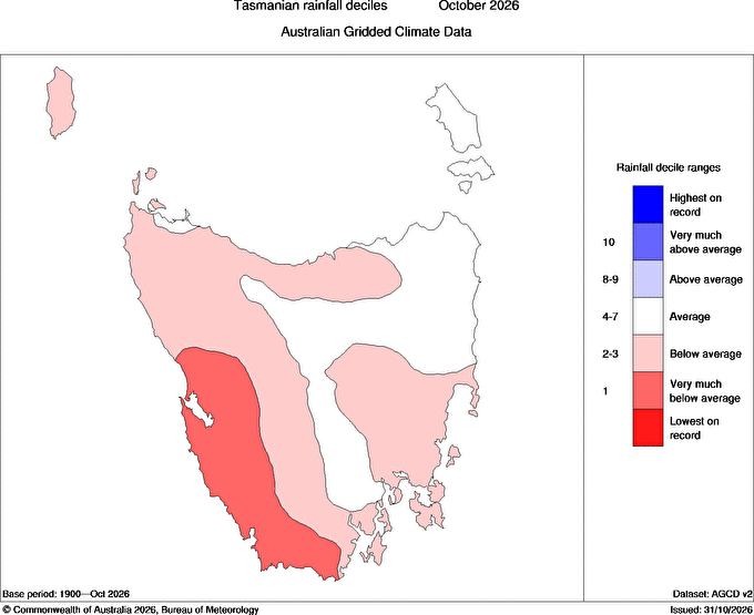
Image: Tasmanian rainfall deciles for October 2026 showing drier than normal conditions. Source: Bureau of Meteorology.
Locations across western and southern Tasmania experienced between 45 and 65% of their typical October rainfall. Hobart received 34mm during the month, 55% of its the normal October rainfall of 63mm.