
Heaviest Melbourne rain in 30 months as Vic flood threat increases
Melbourne has had its wettest day in exactly two-and-a-half years, with 48.4 mm recorded in the city's main Olympic Park gauge in the 24 hours to 9 am Friday.
Meanwhile, rain continues to spread east across Victoria, with a flood watch current for parts of Gippsland, the North East forecast district and large parts of central Victoria.
The 12-hour radar loop below shows the relentless bands of rain which swept across Victoria overnight.
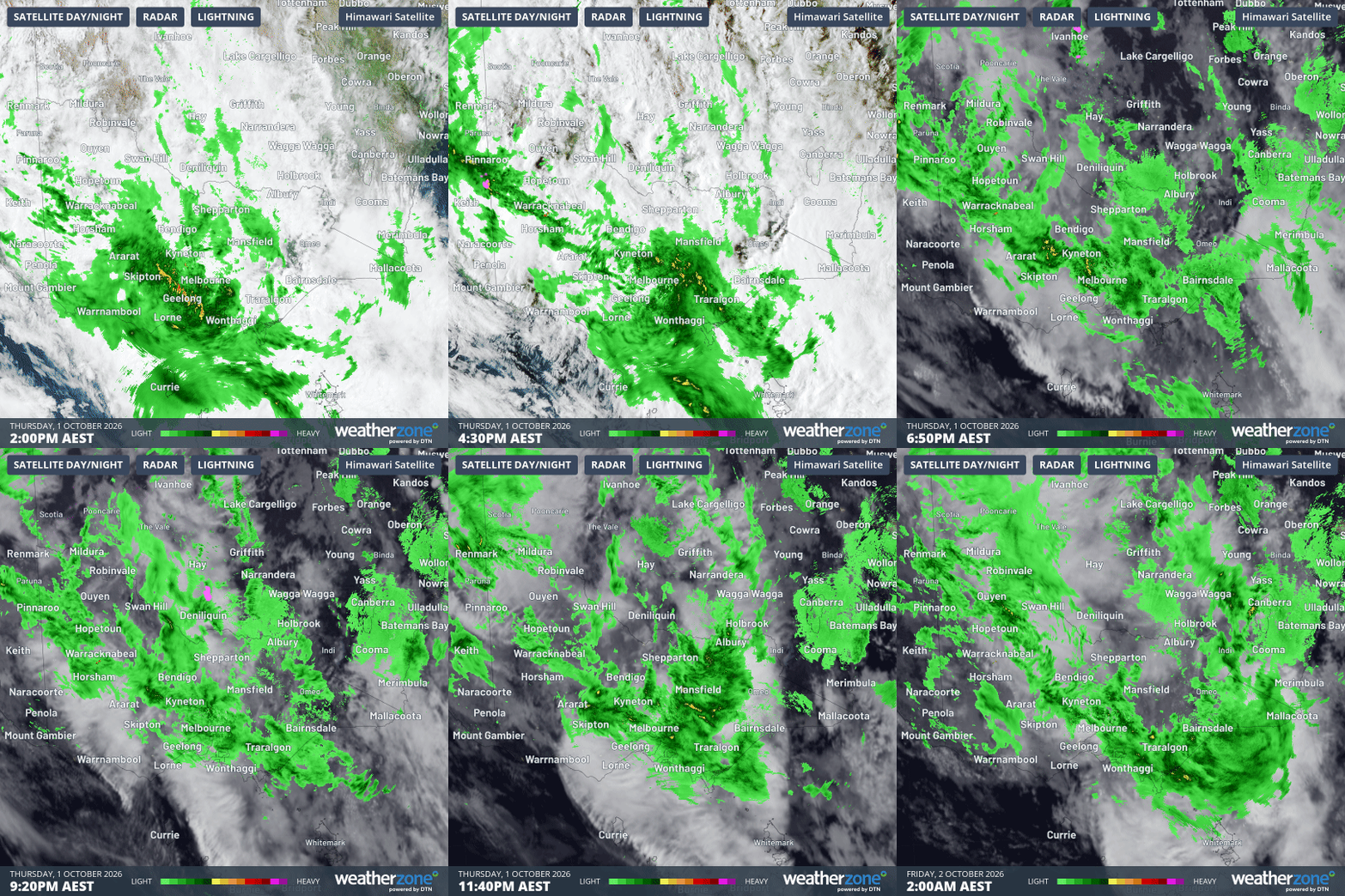
Image: 12-hour combined radar and satellite loop for Victoria up until 2 am (AEST) on Friday, October 2, 2026, Source: Weatherzone.
Melbourne almost tops Victorian rainfall totals
Melbourne doesn't often have the highest rainfall total in Victoria in any given 24-hour period, but it came close in the 24 hours to 9 am this Friday.
- Melbourne's 48.4 mm was the city's heaviest daily rainfall since April 2, 2024, when it received 53.2 mm.
- October is typically Melbourne's wettest month, with an average of 65.7mm, yet Melbourne still received 74% of its average monthly rainfall in just one day.
- Mount Moornapa in Gippsland had the state’s highest reading with 50.8 mm – only 2.4 millimetres more than Melbourne.
- Further afield in Victoria's NW corner, the Mallee region town of Walpeup received 30.4 mm, which was 89% of its October average of 34.2 mm.
Melbourne's rain was heaviest during Thursday afternoon, with 17 mm falling between 3 pm and 4 pm. Numerous traffic incidents were reported, including vehicles which had become trapped in partially submerged roads close to the CBD.
While wet conditions have persisted across much of the city beyond 9 am this Friday, the rainband is beginning to break up and steady rain should turn to showers later this morning.
Thunderstorms will likely develop again on Friday afternoon both in Melbourne and across much of Victoria, while Saturday also looks wet in many areas, including Melbourne, as today's northwesterly winds swing around to the southeast.
Low develops as Gippsland braces for more heavy rain
The current band of rain which covers virtually all of eastern and central Victoria is associated with a slow-moving trough. A broad low pressure system will develop over northern Victoria later today.
This low will also be slow moving and is not expected to drift out into eastern Bass Strait until early on Sunday. Until then, very wet conditions will persist in some areas, especially the Gippsland region.
While the risk of flooding will be a major concern for Gippsland residents, the wet weather will be welcomed by many, as eastern Victoria has endured a prolonged rainfall deficit in recent months.
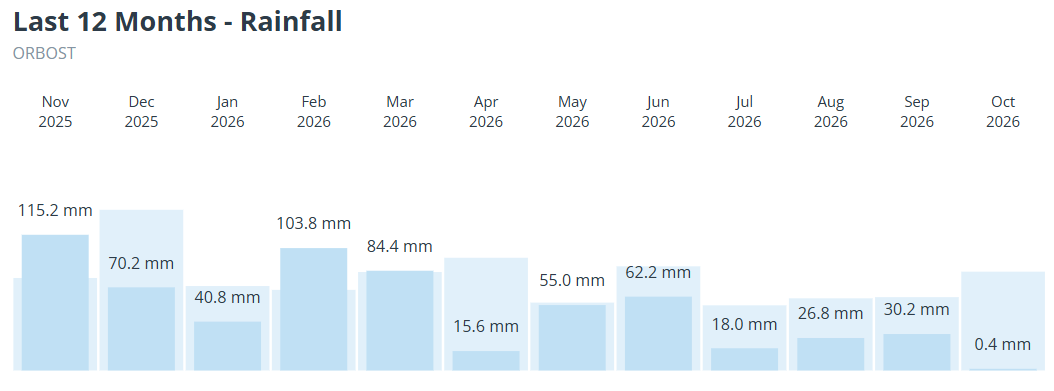
Image: Monthly rainfall (dark blue) compared to the monthly average (light blue) for Orbost, Vic, over the last 12 months. Source: Weatherzone.
As shown in the above graph for Orbost (in East Gippsland, near the mouth of the Snowy River), rainfall was below average in each of the six months from April to September.
This is a potentially dangerous period for Victoria, and also for some adjacent parts of SA and NSW, so please check the latest information on the Weatherzone warnings page as this system continues to develop.