
Big week of showers and storms for outback Australia
Showers and storms will develop across a large portion of Australia this week, including in relatively dry parts of the interior.
The storms will be caused by a series of troughs moving across the country, as a ridge of high pressure is centred over waters south of the continent for most of the week.
Here's a quick look at where showers and storm activity could occur in each state and territory this week.
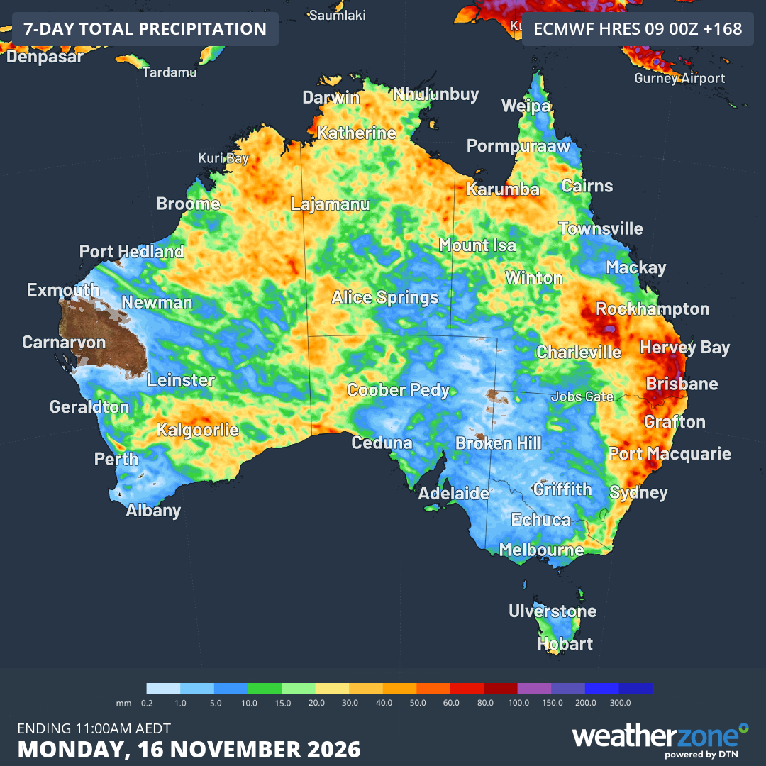
Image: Accumulated rainfall across Australia from Monday November 9 to 11 am (AEDT) on Monday, November 16, 2026, according to the ECMWF model. Source: Weatherzone.
Western Australia
At a time of year when rainfall activity starts to ramp up in WA's north and declines markedly in the state's south, showers and storms will be remarkably widespread in WA this week.
While Perth looks likely to miss out on all but the lightest drop, rain could fall from the Kimberley and Pilbara in northern WA down through regions like the Gascoyne, Goldfields and the North and South Interior, all the way south to the Eucla and eastern parts of the South West Land Division
The potential for showers and storms is higher earlier in the week in northern WA, and increases throughout the week in southern and eastern regions.
South Australia
A band of showers and storms moved through SA on Monday afternoon, however accumulated totals have been generally less than 5 mm, while Adelaide itself didn't record a drop to 5 pm (ACDT).
Adelaide should remain dry during the week ahead, however showers and storms will develop in SA's far west and north by Thursday. Unusually, the North West Pastoral forecast district is the SA region most likely to see significant rainfall between Tuesday and Friday.
Northern Territory
The Top End wet season is not yet fully into swing and Darwin can expect a string of mostly sunny days with only the slight chance of an afternoon shower until Friday.
Further south in the territory, it's a different story. By Thursday and Friday, there's the chance of heavy falls of rain and thunderstorms in the Lasseter forecast district in the NT's south, which includes Yulara and Uluru.
Potentially, this could be the second significant rainfall event at Uluru in two weeks, after Yulara caught 41 mm of rain at the end of October, and the rain didn't miss nearby Uluru, as illustrated in the image below.
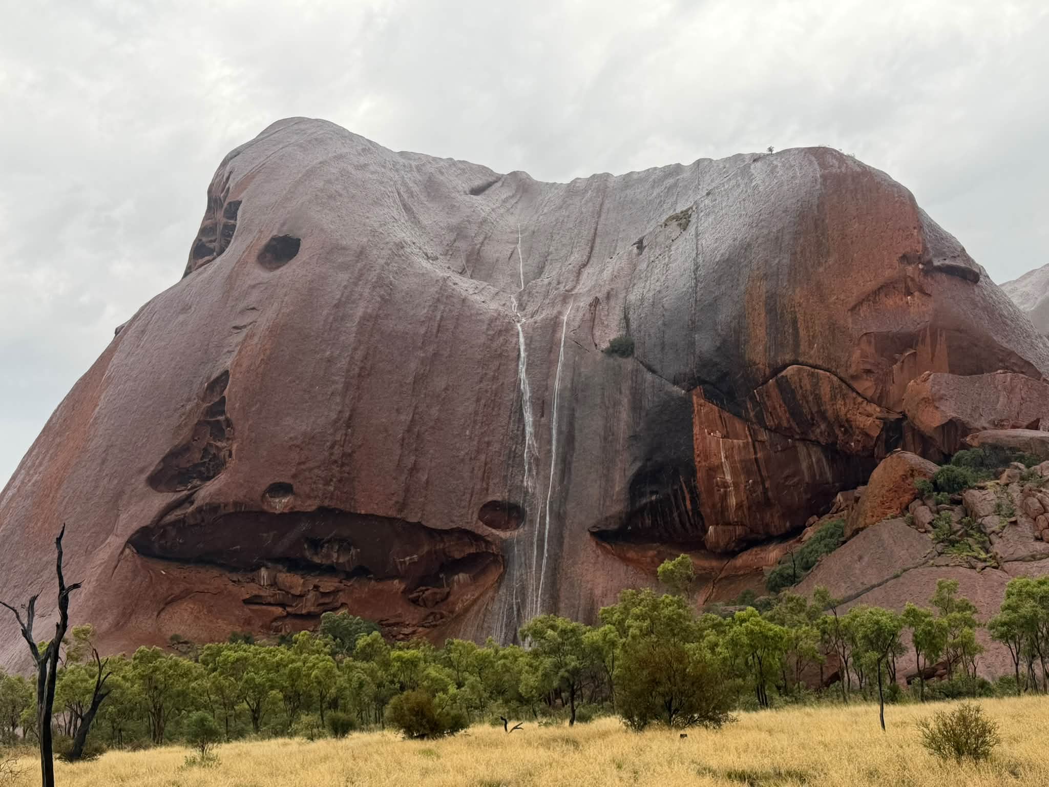
Image: Temporary waterfalls on Uluru in late October, 2026. Source: Billy Hall (oz_eco_tours) on Threads.
Queensland
Showers and storms will develop in northwestern Queensland on Tuesday and Wednesday and spread in an arc across the state all the way to the southeast, where Brisbane can expect showers and/or storms just about every day this week from Tuesday onwards.
Severe thunderstorms with locally heavy rainfall, large hail, and damaging wind gusts are possible across a broad sweep of central and southeastern Queensland on Wednesday into Thursday.
Victoria
Most of Australia's dynamic wet weather will be located much further north than Victoria this week. But isolated showers and storms are still possible across much of the state, especially in the east towards the end of the week.
Melbourne should be dry and mostly sunny right through until at least Saturday.
New South Wales/ACT
By midweek, the northeast corner of NSW and some other areas in the state's north could see some severe thunderstorms in the same outbreak of dynamic weather that is due in South East Queensland.
Showers are also possible in coastal districts on most days, while the rest of the state (including Canberra and the ACT) should be largely dry until the weekend, when rain looks likely to intensify along the coast and adjacent ranges as a coastal trough develops.
Tasmania
A shower here and there can be expected on the Tasmanian coast at various times throughout the week, but the dominant ridge of high pressure centred over the waters of the Great Australian Bight will ensure relatively dry, mild, uneventful weather in our southernmost state for much of this week.