
Big temperature drops coming as huge cloudband crosses Australia
A vast cloudband is the dominant feature on Australian weather charts this Thursday, and while there’s not a huge amount of rain associated with it, the cloudband is part of a broader weather system which will deliver another significant spring temperature swing to southeastern Australia.
From the end of the working week into the weekend, the five southeastern capital cities will all warm up, then shed between 8 and 11 degrees in their maximum temperatures, as a fresh burst of cold air chills Tasmania and the southeast mainland.
- Melbourne should reach 26°C this Thursday, before peaking around just 15°C on a chilly and somewhat wet AFL Grand Final day on Saturday.
- Adelaide will have the smallest temperature fluctuation of the SE capitals due to the coldest air only flicking Tasmania and the far southeast mainland, but the SA capital’s maximum will still cool down from around 26°C this Thursday to 19°C or 18°C on both weekend days.
- Hobart should reach 22°C this Thursday before falling to a maximum of just 13°C on Saturday.
- The cool change will arrive around a day later in Canberra than in cities further south and west, with the national capital’s Saturday temperature likely to peak around 28°C before Sunday’s maximum drops to 16°C.
- Sydney should reach 29°C on Saturday and the coolest air won’t arrive until late Sunday or early Monday, when the maximum will be around 19°C.
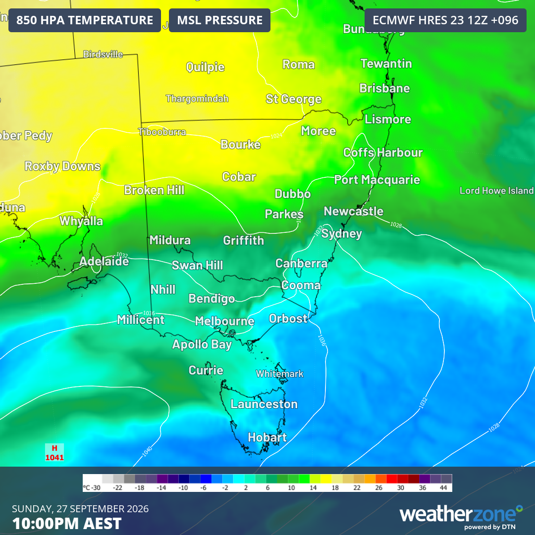
Image: Mean sea level pressure and 850 hPa temperatures forecast for 10 pm (AEST) on Sunday, September 27, 2026, according to the ECMWF model. Source: Weatherzone.
The image above shows the cold air reaching the ACT and creeping up the NSW coast towards Sydney on Sunday evening.
Impressive cloudband on satellite image, but only patchy rain
While the cloudband crossing Australia looks impressive on satellite imagery, only patchy areas of light rain are associated with it.
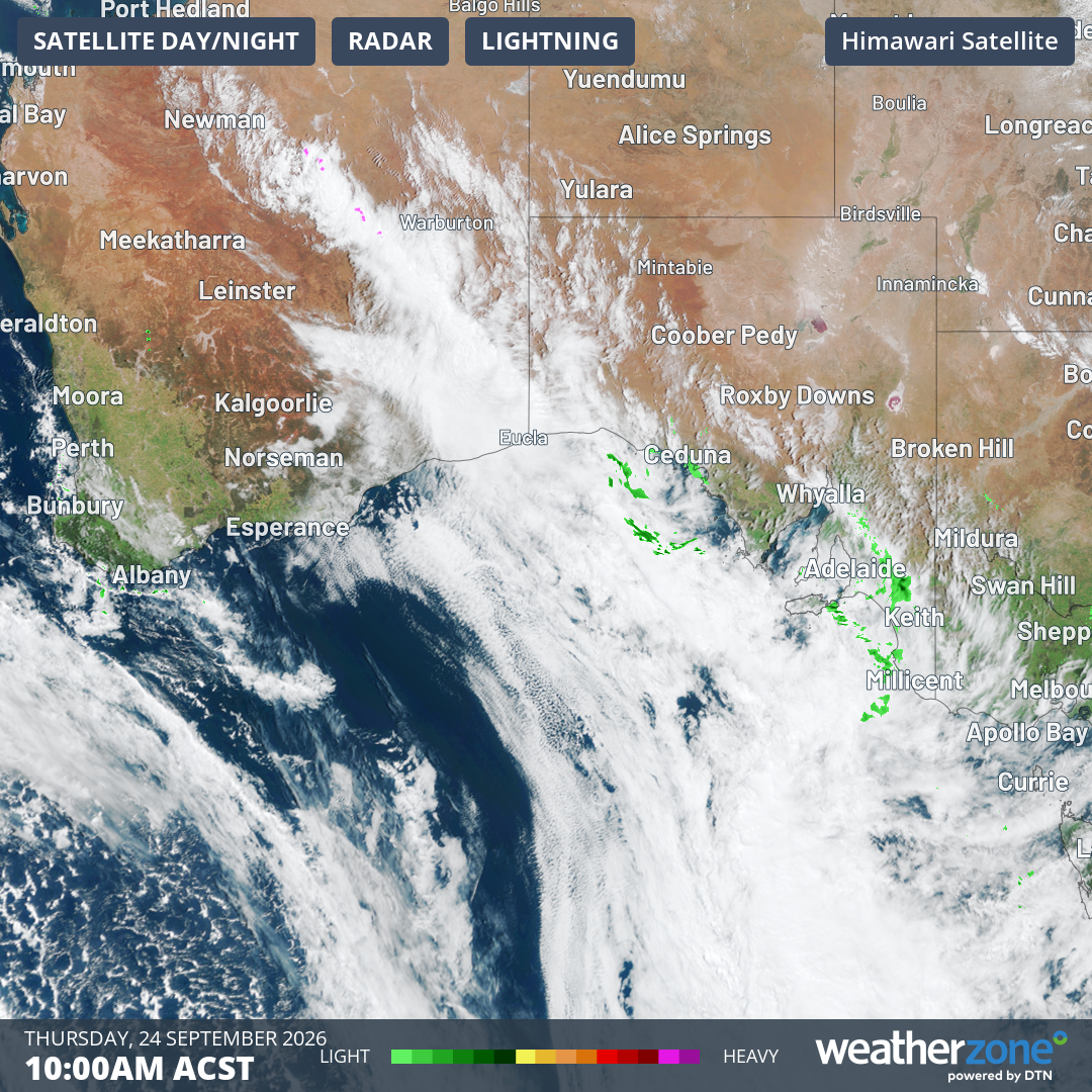
Image: Satellite and radar image for parts of southwest WA, South Australia, and parts of nearby states and territories at 10:00 am (ACST) on Thursday, September 24, 2026. Source: Weatherzone.
There’s only a slight chance of a shower in Adelaide this Thursday and Friday, although the likelihood increases on Saturday as winds swing to the southeast.
Any rain will please most locals. After four very welcome months of above-average rainfall, September in Adelaide has been dry, with just 13.2 mm recorded to date. The monthly average is 50.3 mm.
After winter rainfall which was around the long-term average, Melbourne has also been relatively dry this September so far, with 14.2 mm in the gauge compared to the long-term monthly average of 56.8 mm.
The likely showers on Friday evening and AFL Grand Final day might make for a slippery surface on the MCG but they will do local parks and gardens the world of good.
Snowfalls the day after the last Australian ski resort closes
The snow gods will have the last laugh in the mountains. After a disappointing 2026 Australian snow season, Perisher will close this Friday, after all other Australian ski areas closed at least two weeks ago – and some didn’t even make it through August.
It’s quite the irony, then, that snow is forecast for the Australian Alps this weekend, with the snow level potentially dropping to 1400 or 1500 metres by Sunday in NSW and Victoria, and as low as 700 metres above sea level in Tasmania on Saturday.
And please remember to check forecasts daily at this time of year, as spring is the season when Australia's weather forecasts are most likely to change slightly from day to day.